Cof Cymru: National Historic Assets of Wales · Wales
Treasury Gateway (formerly listed separately)
St. David's and the Cathedral Close, Pembrokeshire, Wales
A Grade II listed building in St. David's and the Cathedral Close, Pembrokeshire, designated on 26 August 1981.
The record
- Designation
- Listed building, Grade II
- Broad class
- Domestic
- Date of designation
- 26 August 1981
- Community
- St. David's and the Cathedral Close
- Unitary authority
- Pembrokeshire
- Country
- Wales
- Coordinates
- 51.88276, -5.26926
- Cadw reference
- 12561
Slide toward Today to fade the historical sheet and see the modern map underneath.
David Rumsey Map Collection, Stanford LibrariesDavid Rumsey Map Collection, Stanford LibrariesDavid Rumsey Map Collection, Stanford LibrariesDavid Rumsey Map Collection, Stanford LibrariesDavid Rumsey Map Collection, Stanford Libraries
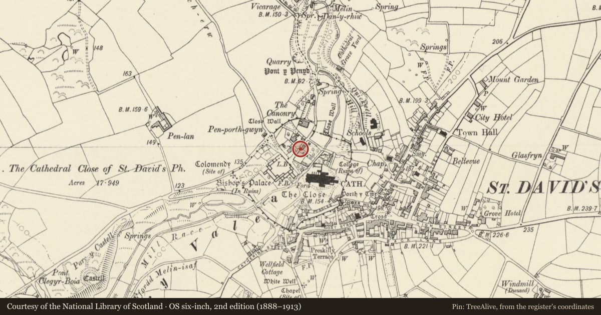
5 historical maps cover this location, the earliest the 1608 map "(13) Cambriae Typus." (David Rumsey Map Collection, Stanford Libraries).
Historical maps covering this location
- 1608 · (13) Cambriae Typus. (David Rumsey Map Collection, Stanford Libraries)
- 1636 · Cornubia : Devonia, Somersetus, Dorcestria, Wiltonia, Glocestria ... (David Rumsey Map Collection, Stanford Libraries)
- 1637 · Particular description of Wales. Cambria seu Wallia (David Rumsey Map Collection, Stanford Libraries)
- 1898 · 209 St David's (Hills) (David Rumsey Map Collection, Stanford Libraries)
- 1901 · Sheet 13. (David Rumsey Map Collection, Stanford Libraries)
Cadw's description
Location
Situated bordering on footpath running NW from Pen-y-ffos and on road running NE to the Treasurer's House, enclosing SW and NW sides of garden S of Treasury Cottage.
History
Uncertain date, high rubble stone garden wall with C20 rebuilt crenellations capped in imitation slate. About 25m length to footpath to Pen-y-ffos, with blocked possibly ancient Tudor-arched doorway close to Pen-y-ffos. Footpath is cobbled in reddish cobbles with a date 1705 in white stones at N end. The wall is marked with outbuilding or summerhouse in NW angle on Joseph Lord's 1720 map, though NW angle is shown more acutely pointed than present right angle.
Exterior
Along roadside, about 38m length back to Treasury Cottage, terminating at Treasury Gateway, a Tudor-arched carriage entry with cut stone voussoirs, probably C19. 1970s imitation slate coping. Broad E jamb with rounded recess or porter's seat, the seat itself a single piece of hollowed granite, supposedly the stone on which St Patrick sat when he had a vision of all Ireland and the people calling him to return.
Reason for designation
Group value.
Nearby in the register
- Treasurer's HouseDomesticunder 1 mi
- Front Garden Wall & Gatepiers & Gate to Brecon HouseDomesticunder 1 mi
- Treasury CottageDomesticunder 1 mi
- Garden Wall between Pen-y-Ffos and the Treasurer's HouseDomesticunder 1 mi
Other entries of the same register within about three miles of this one, by straight line.