Cof Cymru: National Historic Assets of Wales · Wales
Wall of walled garden to S. of Cloister Hall
St. David's and the Cathedral Close, Pembrokeshire, Wales
A Grade II listed building in St. David's and the Cathedral Close, Pembrokeshire, designated on 26 August 1981.
The record
- Designation
- Listed building, Grade II
- Broad class
- Domestic
- Date of designation
- 26 August 1981
- Community
- St. David's and the Cathedral Close
- Unitary authority
- Pembrokeshire
- Country
- Wales
- Coordinates
- 51.88239, -5.26814
- Cadw reference
- 12557
Slide toward Today to fade the historical sheet and see the modern map underneath.
David Rumsey Map Collection, Stanford LibrariesDavid Rumsey Map Collection, Stanford LibrariesDavid Rumsey Map Collection, Stanford LibrariesDavid Rumsey Map Collection, Stanford LibrariesDavid Rumsey Map Collection, Stanford Libraries
5 historical maps cover this location, the earliest the 1608 map "(13) Cambriae Typus." (David Rumsey Map Collection, Stanford Libraries).
Historical maps covering this location
- 1608 · (13) Cambriae Typus. (David Rumsey Map Collection, Stanford Libraries)
- 1636 · Cornubia : Devonia, Somersetus, Dorcestria, Wiltonia, Glocestria ... (David Rumsey Map Collection, Stanford Libraries)
- 1637 · Particular description of Wales. Cambria seu Wallia (David Rumsey Map Collection, Stanford Libraries)
- 1898 · 209 St David's (Hills) (David Rumsey Map Collection, Stanford Libraries)
- 1901 · Sheet 13. (David Rumsey Map Collection, Stanford Libraries)
Cadw's description
Location
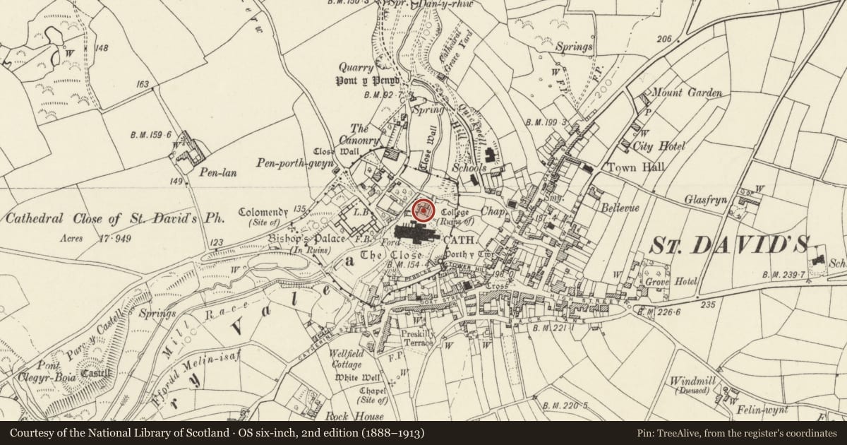
Situated to S of Cloister Hall, the S wall backing onto the N side of the cathedral precinct, the W wall onto the garden behind the Cathedral Hall and the E wall onto the footpath running N from the precinct.
History
Probably (mostly) early C19 but possibly incorporating on the E, W and S sides part of the precinct wall of St Mary's College of which the undercroft survives behind the N wall and under Cloister Hall.
Exterior
Rubble stone garden wall, partly incorporating on N side basement wall of Cloister Hall and, to left, end wall of C14 undercroft behind Cloister Hall. E side, to footpath, has door at right end. S side is embanked against outer side, facing cathedral. Square headed blocked opening at W end. W wall has low 6m length to SW corner then high 4m length, the front wall of a square tower presumably built over undercroft with access from raised garden of Cloister Hall, then lower 2+m section to NW angle. On N side, left end has low segmental arch into undercroft and then continues to basement of Cloister Hall with door into parallel undercroft.
Reason for designation
Group value.
Nearby in the register
- Cloister HallReligious, Ritual and Funeraryunder 1 mi
- St Davids Cathedral Close: Cloister Hall (Undercroft only)Undercroftunder 1 mi
- Undercrofts of former St Mary's College, beneath & to the rear of The Cloister HallDomesticunder 1 mi
- St David's Cathedral Hall (formerly Chapel of St Mary's College) & attached Cloister RuinsReligious, Ritual and Funeraryunder 1 mi
Other entries of the same register within about three miles of this one, by straight line.