Cof Cymru: National Historic Assets of Wales · Wales
Ty'Rhedyn Bach
Newport, Pembrokeshire, Wales
A Grade II listed building in Ffordd Cilgwyn, Newport, Pembrokeshire, designated on 14 April 1992.
The record
- Designation
- Listed building, Grade II
- Broad class
- Domestic
- Date of designation
- 14 April 1992
- Locality
- Ffordd Cilgwyn
- Community
- Newport
- Unitary authority
- Pembrokeshire
- Country
- Wales
- Coordinates
- 52.01219, -4.82048
- Cadw reference
- 12531
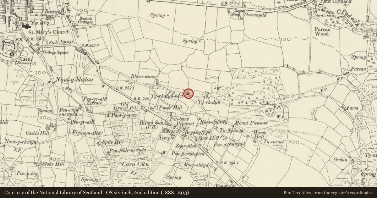
Slide toward Today to fade the historical sheet and see the modern map underneath.
David Rumsey Map Collection, Stanford LibrariesDavid Rumsey Map Collection, Stanford LibrariesDavid Rumsey Map Collection, Stanford LibrariesDavid Rumsey Map Collection, Stanford LibrariesDavid Rumsey Map Collection, Stanford Libraries
5 historical maps cover this location, the earliest the 1608 map "(13) Cambriae Typus." (David Rumsey Map Collection, Stanford Libraries).
Historical maps covering this location
- 1608 · (13) Cambriae Typus. (David Rumsey Map Collection, Stanford Libraries)
- 1891 · Sheet 10. Ordnance Survey of England and Wales. . (David Rumsey Map Collection, Stanford Libraries)
- 1898 · 210 Cardigan (Hills) (David Rumsey Map Collection, Stanford Libraries)
- 1898 · 210 Cardigan (Outline) (David Rumsey Map Collection, Stanford Libraries)
- 1901 · Sheet 13. (David Rumsey Map Collection, Stanford Libraries)
Cadw's description
Location
Situated off un-named lane running E off Cilgwyn road, some 0.8km SE of Newport Church and approached down track joining lane some 200m E of Cilgwyn road junction. Partly covered in creeper.
Exterior
Early to mid C19 small house in colourwashed rubble stone with slate roof and stone end stacks, larger to S end. Two-storeys, double fronted with 2 4-pane large casements above, 4-pane sash to ground floor right, paired plate glass sashes to ground floor left and centre ledged door. Cambered stone heads to door and right window, left window obscured. Slate sills. Lean-to rear with 2 modern dormers.
Reason for designation
Included as good example of smaller 2-storey houses typical of the hillside above Newport.
Nearby in the register
- Ty'RffynnonDomesticunder 1 mi
- Carn Ingli Round BarrowsRound Barrowunder 1 mi
- Pillar Cross 140m SE of Newport ChurchCross-marked stoneunder 1 mi
- Carn Llwyd ring cairnRing Cairnunder 1 mi
Other entries of the same register within about three miles of this one, by straight line.