Cof Cymru: National Historic Assets of Wales · Wales
Outbuildings to NE.of Penfiedir
Newport, Pembrokeshire, Wales
A Grade II listed building in Ffordd Bedd Morris, Newport, Pembrokeshire, designated on 14 April 1992.
The record
- Designation
- Listed building, Grade II
- Broad class
- Agriculture and Subsistence
- Date of designation
- 14 April 1992
- Locality
- Ffordd Bedd Morris
- Community
- Newport
- Unitary authority
- Pembrokeshire
- Country
- Wales
- Coordinates
- 52.01285, -4.84660
- Cadw reference
- 12530
Slide toward Today to fade the historical sheet and see the modern map underneath.
David Rumsey Map Collection, Stanford LibrariesDavid Rumsey Map Collection, Stanford LibrariesDavid Rumsey Map Collection, Stanford LibrariesDavid Rumsey Map Collection, Stanford LibrariesDavid Rumsey Map Collection, Stanford Libraries
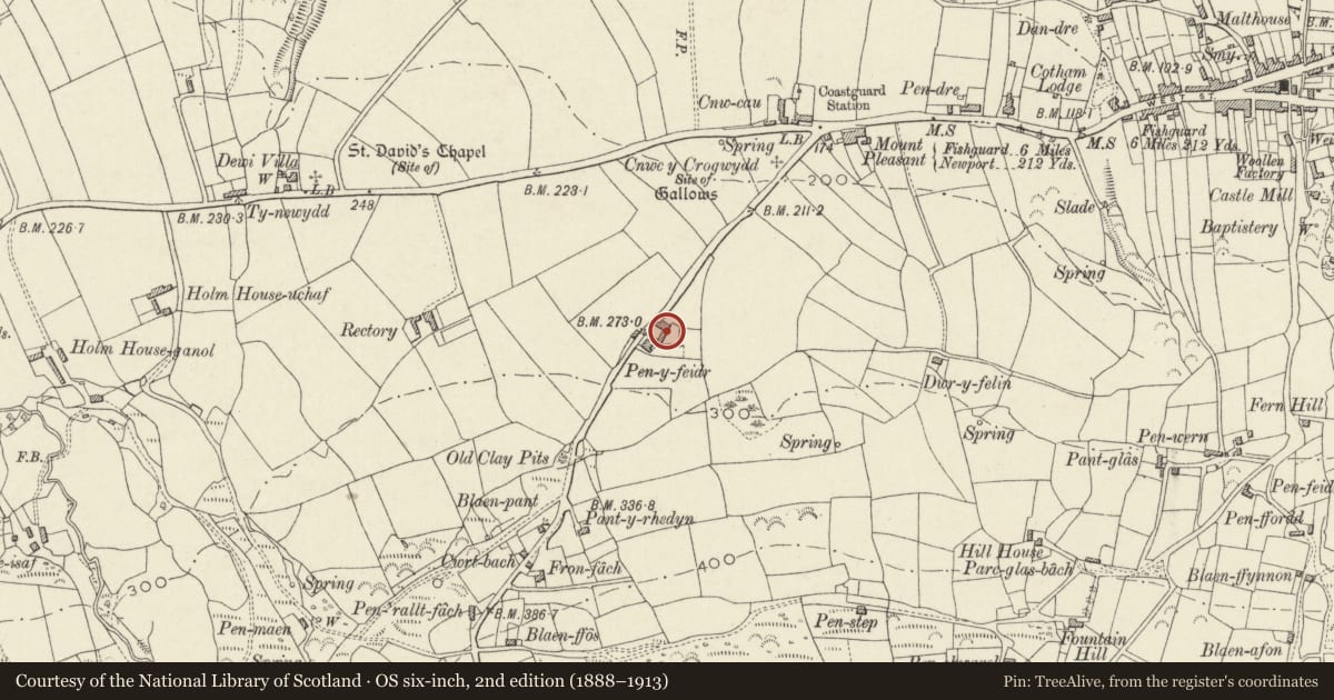
5 historical maps cover this location, the earliest the 1608 map "(13) Cambriae Typus." (David Rumsey Map Collection, Stanford Libraries).
Historical maps covering this location
- 1608 · (13) Cambriae Typus. (David Rumsey Map Collection, Stanford Libraries)
- 1891 · Sheet 10. Ordnance Survey of England and Wales. . (David Rumsey Map Collection, Stanford Libraries)
- 1898 · 210 Cardigan (Hills) (David Rumsey Map Collection, Stanford Libraries)
- 1898 · 210 Cardigan (Outline) (David Rumsey Map Collection, Stanford Libraries)
- 1901 · Sheet 13. (David Rumsey Map Collection, Stanford Libraries)
Cadw's description
Location
Situated overlooking farm court adjoining farmhouse, by roadside some
300m SW of junction with A487.
History
Dated 1811, raised in later C19.
Exterior
L-plan range of outbuildings in rubble stone with slate roofs, originally single-storey, the S end raised to 2 storeys. S end range has 4 boarded loft openings with cambered heads and stone voussoirs above and ground floor finely cut, arched carriage entry to left with stone arch and rebated jambs. Plaque reads 'George Lloyd
erected 1811'. Centre and right doors with cambered heads, voussoirs and keystones.
Single storey range to left has (from right): C20 metal window with timber lintel, door with stone voussoirs and keystone but doorway altered below and another doorway with stone voussoirs and keystone, then range returns with one similar doorway and W end altered in C20 with concrete block additions.
Reason for designation
The outbuildings appear not to be marked on 1840 Tithe Map, though the house is (possibly an error).
Group value with farmhouse
Nearby in the register
- PenfeidirDomesticunder 1 mi
- Gelli OlauDomesticunder 1 mi
- Mount ViewDomesticunder 1 mi
- The PoundAgriculture and Subsistenceunder 1 mi
Other entries of the same register within about three miles of this one, by straight line.