Cof Cymru: National Historic Assets of Wales · Wales
Spring Hill
Newport, Pembrokeshire, Wales
A Grade II listed building in Newport, Pembrokeshire, designated on 14 April 1992.
The record
- Designation
- Listed building, Grade II
- Broad class
- Domestic
- Date of designation
- 14 April 1992
- Community
- Newport
- Unitary authority
- Pembrokeshire
- Country
- Wales
- Coordinates
- 52.01797, -4.83719
- Cadw reference
- 12501
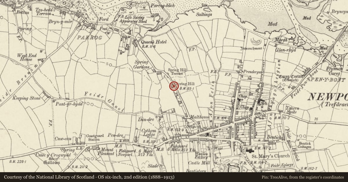
Slide toward Today to fade the historical sheet and see the modern map underneath.
David Rumsey Map Collection, Stanford LibrariesDavid Rumsey Map Collection, Stanford LibrariesDavid Rumsey Map Collection, Stanford LibrariesDavid Rumsey Map Collection, Stanford LibrariesDavid Rumsey Map Collection, Stanford Libraries
5 historical maps cover this location, the earliest the 1608 map "(13) Cambriae Typus." (David Rumsey Map Collection, Stanford Libraries).
Historical maps covering this location
- 1608 · (13) Cambriae Typus. (David Rumsey Map Collection, Stanford Libraries)
- 1891 · Sheet 10. Ordnance Survey of England and Wales. . (David Rumsey Map Collection, Stanford Libraries)
- 1898 · 210 Cardigan (Hills) (David Rumsey Map Collection, Stanford Libraries)
- 1898 · 210 Cardigan (Outline) (David Rumsey Map Collection, Stanford Libraries)
- 1901 · Sheet 13. (David Rumsey Map Collection, Stanford Libraries)
Cadw's description
Location
Semi-detached pair situated some 300m N of junction with West Street.
Exterior
Mid to later C19 pair of substantial houses with coursed rubble stone fronts, slate roofs and stone ridge and end-wall stacks. Two-storeys and loft, each with 3-window range of hornless 12-pane sashes and centre doors. Cut stone voussoirs and slate sills to windows, 6-panel doors with four fielded panels, panelled reveals and timber pedimented doorcases. Open pediments on carved brackets. Plain overlights over doors. Both houses are raised on rubble stone terrace, higher at N end, with plain iron railings.
N end wall is roughcast with 2 ground floor sashes and one to first floor, all 12-pane with horns. Small loft light.
Reason for designation
A good and little altered pair of houses with doorcases of quality.
Nearby in the register
- Spring HillDomesticunder 1 mi
- Trem y donNo class recordedunder 1 mi
- Medieval Pottery Kiln, Newport Memorial HallPottery Kilnunder 1 mi
- GwaunfaNo class recordedunder 1 mi
Other entries of the same register within about three miles of this one, by straight line.