Cof Cymru: National Historic Assets of Wales · Wales
One of Five Cottages making up Y Stryd/The Terrace
Llanrhian, Pembrokeshire, Wales
A Grade II listed building in Porthgain, Llanrhian, Pembrokeshire, designated on 4 February 1991.
The record
- Designation
- Listed building, Grade II
- Broad class
- Domestic
- Date of designation
- 4 February 1991
- Locality
- Porthgain
- Community
- Llanrhian
- Unitary authority
- Pembrokeshire
- Country
- Wales
- Coordinates
- 51.94749, -5.18054
- Cadw reference
- 12431
Slide toward Today to fade the historical sheet and see the modern map underneath.
David Rumsey Map Collection, Stanford LibrariesDavid Rumsey Map Collection, Stanford LibrariesDavid Rumsey Map Collection, Stanford LibrariesDavid Rumsey Map Collection, Stanford LibrariesDavid Rumsey Map Collection, Stanford Libraries
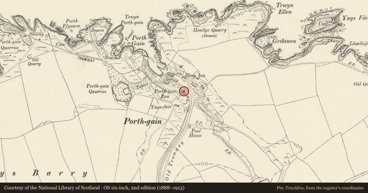
5 historical maps cover this location, the earliest the 1608 map "(13) Cambriae Typus." (David Rumsey Map Collection, Stanford Libraries).
Historical maps covering this location
- 1608 · (13) Cambriae Typus. (David Rumsey Map Collection, Stanford Libraries)
- 1636 · Cornubia : Devonia, Somersetus, Dorcestria, Wiltonia, Glocestria ... (David Rumsey Map Collection, Stanford Libraries)
- 1637 · Particular description of Wales. Cambria seu Wallia (David Rumsey Map Collection, Stanford Libraries)
- 1898 · 209 St David's (Hills) (David Rumsey Map Collection, Stanford Libraries)
- 1901 · Sheet 13. (David Rumsey Map Collection, Stanford Libraries)
Cadw's description
Location
Situated at southern end of the western range of buildings in Porthgain.
History
Ca 1850-60 terrace of five single-storey workers’ cottages built for workmen at Porthgain slate quarries. Thoroughly renovated ca 1985. Rubble stone with slate roof and six squared stone chimney stacks. Each cottage has central boarded door and 12-pane sash each side. Rendered S end wall with one ground floor window.
Old photographs shows S end wall was slate-hung and front walls colourwashed. Graded small slates to roofs. A two storey house, now ruined, adjoined at N end with single storey range beyond and then, at right angles, a large mill building with water-wheel. The leat to the wheel survives in the raised terrace in front of the row. The row was formerly known as Porthgain Row. There were similar rows in the cliff top at Porthgain (Pen-top Row) and at Abereiddy (Abereiddy Row), both derelict by early C20, and this remains a rare survival of industrial workers’ housing in rural SW Wales. The houses were probably built for Messrs Barclays & Co quarry owners 1840-55, and are marked on an 1860 sale plan.
Nearby in the register
- One of Five Cottages making up Y Stryd/The TerraceDomesticunder 1 mi
- One of Five Cottages making up Y Stryd/The TerraceDomesticunder 1 mi
- One of Five Cottages making up Y Stryd/The TerraceDomesticunder 1 mi
- One of Five cottages making up Y Stryd/The TerraceDomesticunder 1 mi
Other entries of the same register within about three miles of this one, by straight line.