Cof Cymru: National Historic Assets of Wales · Wales
Park House
Fishguard and Goodwick, Pembrokeshire, Wales
A Grade II listed building in Fishguard, Fishguard and Goodwick, Pembrokeshire, designated on 24 November 1978.
The record
- Designation
- Listed building, Grade II
- Broad class
- Domestic
- Date of designation
- 24 November 1978
- Locality
- Fishguard
- Town
- Fishguard
- Community
- Fishguard and Goodwick
- Unitary authority
- Pembrokeshire
- Country
- Wales
- Coordinates
- 51.99314, -4.97365
- Cadw reference
- 12338
Slide toward Today to fade the historical sheet and see the modern map underneath.
David Rumsey Map Collection, Stanford LibrariesDavid Rumsey Map Collection, Stanford LibrariesDavid Rumsey Map Collection, Stanford LibrariesDavid Rumsey Map Collection, Stanford LibrariesDavid Rumsey Map Collection, Stanford Libraries
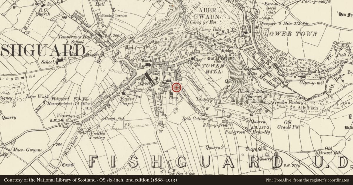
5 historical maps cover this location, the earliest the 1608 map "(13) Cambriae Typus." (David Rumsey Map Collection, Stanford Libraries).
Historical maps covering this location
- 1608 · (13) Cambriae Typus. (David Rumsey Map Collection, Stanford Libraries)
- 1891 · Sheet 10. Ordnance Survey of England and Wales. . (David Rumsey Map Collection, Stanford Libraries)
- 1898 · 210 Cardigan (Hills) (David Rumsey Map Collection, Stanford Libraries)
- 1898 · 210 Cardigan (Outline) (David Rumsey Map Collection, Stanford Libraries)
- 1901 · Sheet 13. (David Rumsey Map Collection, Stanford Libraries)
Cadw's description
Location
Situated in own grounds at the corner of Park Street and Kensington Street.
History
Early to mid C19 house, altered in late C20 restoration. Building on this site on 1844 tithe map.
Exterior
House, stone rubble, with imitation slate roof, wide bracketed eaves and stone end stacks. Two-storey, 3-window range of 12-pane sash windows and central doorway. One slate step up to 7-panelled door with traceried overlight. All openings with slightly cambered heads and hard brick voussoirs, renewed in late C20. Service wing to right of one-and-a-half storeys with stone end stack. C20 conservatory at right angles.
Front garden enclosed by stone rubble wall with rounded rendered coping and centre piers either side of gateway. Gateway to yard on left flanked by rounded piers with coping.
At previous listing, roof was of grouted cement and walls of house and garden had pebbledash cladding.
Reason for designation
Included as detached earlier C19 house of late Georgian character.
Nearby in the register
- 17 Kensington StreetDomesticunder 1 mi
- EmscoteDomesticunder 1 mi
- Greenwood HouseDomesticunder 1 mi
- 1 Hottipass StreetDomesticunder 1 mi
Other entries of the same register within about three miles of this one, by straight line.