Cof Cymru: National Historic Assets of Wales · Wales
Railings to churchyard of Church of St Mary
Fishguard and Goodwick, Pembrokeshire, Wales
A Grade II listed building in Fishguard, Fishguard and Goodwick, Pembrokeshire, designated on 24 November 1978.
The record
- Designation
- Listed building, Grade II
- Broad class
- Religious, Ritual and Funerary
- Date of designation
- 24 November 1978
- Locality
- Fishguard
- Town
- Fishguard
- Community
- Fishguard and Goodwick
- Unitary authority
- Pembrokeshire
- Country
- Wales
- Coordinates
- 51.99406, -4.97571
- Cadw reference
- 12301
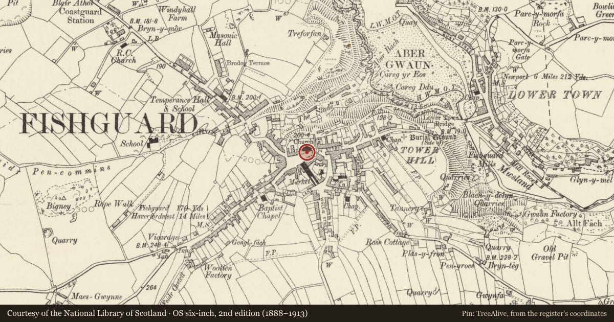
Slide toward Today to fade the historical sheet and see the modern map underneath.
David Rumsey Map Collection, Stanford LibrariesDavid Rumsey Map Collection, Stanford LibrariesDavid Rumsey Map Collection, Stanford LibrariesDavid Rumsey Map Collection, Stanford LibrariesDavid Rumsey Map Collection, Stanford Libraries
5 historical maps cover this location, the earliest the 1608 map "(13) Cambriae Typus." (David Rumsey Map Collection, Stanford Libraries).
Historical maps covering this location
- 1608 · (13) Cambriae Typus. (David Rumsey Map Collection, Stanford Libraries)
- 1891 · Sheet 10. Ordnance Survey of England and Wales. . (David Rumsey Map Collection, Stanford Libraries)
- 1898 · 210 Cardigan (Hills) (David Rumsey Map Collection, Stanford Libraries)
- 1898 · 210 Cardigan (Outline) (David Rumsey Map Collection, Stanford Libraries)
- 1901 · Sheet 13. (David Rumsey Map Collection, Stanford Libraries)
Cadw's description
Location
Situated on the street line just W of the Market Square along the S boundary of the churchyard.
History
Earlier to mid C19 iron railings on stone plinth with ashlar gatepiers and gate of 1936.
Exterior
Iron railings with spear headed finials, interrupted by main gateway of 1936 with grey stone gatepiers and wrought iron gates and small gateway opposite SE door. The railings are all but invisible in the present hedge.
Reason for designation
Included for group value with the parish church.
Nearby in the register
- Parish Church of St MaryReligious, Ritual and Funeraryunder 1 mi
- 1 Main StreetDomesticunder 1 mi
- The Town HallCivilunder 1 mi
- 3 Main StreetCommercialunder 1 mi
Other entries of the same register within about three miles of this one, by straight line.