Cof Cymru: National Historic Assets of Wales · Wales
2 Grove Place
Haverfordwest, Pembrokeshire, Wales
A Grade II listed building in SE side of St Thomas Green, Haverfordwest, Pembrokeshire, designated on 1 July 1974.
The record
- Designation
- Listed building, Grade II
- Broad class
- Domestic
- Date of designation
- 1 July 1974
- Locality
- SE side of St Thomas Green
- Community
- Haverfordwest
- Unitary authority
- Pembrokeshire
- Country
- Wales
- Coordinates
- 51.79825, -4.97051
- Cadw reference
- 12233
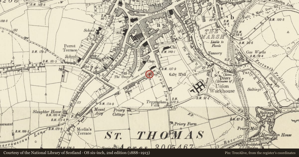
Slide toward Today to fade the historical sheet and see the modern map underneath.
David Rumsey Map Collection, Stanford LibrariesDavid Rumsey Map Collection, Stanford LibrariesDavid Rumsey Map Collection, Stanford LibrariesDavid Rumsey Map Collection, Stanford LibrariesDavid Rumsey Map Collection, Stanford Libraries
5 historical maps cover this location, the earliest the 1608 map "(13) Cambriae Typus." (David Rumsey Map Collection, Stanford Libraries).
Historical maps covering this location
- 1608 · (13) Cambriae Typus. (David Rumsey Map Collection, Stanford Libraries)
- 1636 · Cornubia : Devonia, Somersetus, Dorcestria, Wiltonia, Glocestria ... (David Rumsey Map Collection, Stanford Libraries)
- 1891 · Sheet 10. Ordnance Survey of England and Wales. . (David Rumsey Map Collection, Stanford Libraries)
- 1898 · 228 Haverfordwest (Hills) (David Rumsey Map Collection, Stanford Libraries)
- 1901 · Sheet 13. (David Rumsey Map Collection, Stanford Libraries)
Cadw's description
Exterior
Mid to later C19. 2 storeys. Slate gabled roof. Pebble dash front. Windows 3 panes wide. Door in reveals with very small rectangular fanlight over.
Reason for designation
Description not updated at time of resurvey.
Nearby in the register
- Telephone Call-box adjoining Dyfed County Council OfficesCommunicationsunder 1 mi
- 13 Albany TerraceCommercialunder 1 mi
- No 14 Albany Terrace and outbuilding to rearCommercialunder 1 mi
- 12 Albany TerraceCommercialunder 1 mi
Other entries of the same register within about three miles of this one, by straight line.