Cof Cymru: National Historic Assets of Wales · Wales
26 Regent Street
Llangollen, Denbighshire, Wales
A Grade II listed building in Llangollen, Denbighshire, designated on 22 December 1989.
The record
- Designation
- Listed building, Grade II
- Broad class
- Commercial
- Date of designation
- 22 December 1989
- Community
- Llangollen
- Unitary authority
- Denbighshire
- Country
- Wales
- Coordinates
- 52.96861, -3.16802
- Cadw reference
- 1214
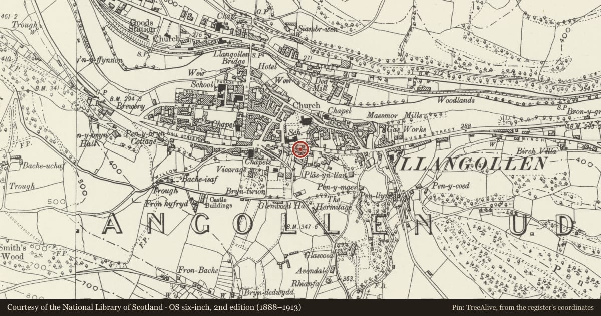
Slide toward Today to fade the historical sheet and see the modern map underneath.
David Rumsey Map Collection, Stanford LibrariesDavid Rumsey Map Collection, Stanford LibrariesDavid Rumsey Map Collection, Stanford LibrariesDavid Rumsey Map Collection, Stanford LibrariesLlyfrgell Genedlaethol Cymru – The National Library of Wales
5 historical maps cover this location, the earliest the 1795 map "To Sir Watkin Williams-Wynn Bart ... the map of the six counties of North Wales is most humbly inscribed by his obedient humble servant" (Llyfrgell Genedlaethol Cymru – The National Library of Wales).
Historical maps covering this location
- 1795 · To Sir Watkin Williams-Wynn Bart ... the map of the six counties of North Wales is most… (Llyfrgell Genedlaethol Cymru – The National Library of Wales)
- 1883 · Watershed map England, Wales 3. (David Rumsey Map Collection, Stanford Libraries)
- 1898 · 121 Wrexham (Hills) (David Rumsey Map Collection, Stanford Libraries)
- 1898 · 121 Wrexham (Outline) (David Rumsey Map Collection, Stanford Libraries)
- 1901 · Sheet 9 and 10. (David Rumsey Map Collection, Stanford Libraries)
Cadw's description
Location
Set into a long line of frontages midway along the street.
History
Earlier C19 (shown on 1844 Tithe map)
Exterior
Simple classical 3-storey, 3-window broad front; painted roughcast with rusticated end quoins and plinth. Modern tiled roof; original bracketed eaves and red brick chimney stacks. Mostly 12 and 16 pane sash windows with moulded architraves, keystones and bracket cills; no glazing bars to 2nd floor left and cill brackets removed to 1st floor left. Central timber panel to 1st floor with raised border and inserted modern windows; formerly a commercial sign for the Sun Brewery. The ground floor has central coach entry serving this former commercial premises. This is flanked to left by a shop front with rounded corner and glazed double doors. To the right of the main opening is a 6-panel door with 2-pane overlight; rusticated architrave. The shop front, coach entry and doorwayy are contained under a deep fascia with cornice.
2 doorways within the through passage, that to the left is pedimented with panneled reveals and that to the right is numbered 26A. Roughcast rear with small pane sash windows; modern extension.
Reason for designation
Group value with Nos 30-34, No 21, The Prince of Wales PH and Cross Lane Nos 4-6.
Nearby in the register
- 28 Regent StreetCommercialunder 1 mi
- Former Pottery WorkshopCommercialunder 1 mi
- (including the Arched Entry to the right)Domesticunder 1 mi
- 34 Regent StreetDomesticunder 1 mi
Other entries of the same register within about three miles of this one, by straight line.