Cof Cymru: National Historic Assets of Wales · Wales
The Pembrokeshire Yeoman
Haverfordwest, Pembrokeshire, Wales
A Grade II listed building in Haverfordwest, Pembrokeshire, designated on 1 July 1974.
The record
- Designation
- Listed building, Grade II
- Broad class
- Commercial
- Date of designation
- 1 July 1974
- Town
- Haverfordwest
- Community
- Haverfordwest
- Unitary authority
- Pembrokeshire
- Country
- Wales
- Coordinates
- 51.79991, -4.97134
- Cadw reference
- 12133
Slide toward Today to fade the historical sheet and see the modern map underneath.
David Rumsey Map Collection, Stanford LibrariesDavid Rumsey Map Collection, Stanford LibrariesDavid Rumsey Map Collection, Stanford LibrariesDavid Rumsey Map Collection, Stanford LibrariesDavid Rumsey Map Collection, Stanford Libraries
5 historical maps cover this location, the earliest the 1608 map "(13) Cambriae Typus." (David Rumsey Map Collection, Stanford Libraries).
Historical maps covering this location
- 1608 · (13) Cambriae Typus. (David Rumsey Map Collection, Stanford Libraries)
- 1636 · Cornubia : Devonia, Somersetus, Dorcestria, Wiltonia, Glocestria ... (David Rumsey Map Collection, Stanford Libraries)
- 1891 · Sheet 10. Ordnance Survey of England and Wales. . (David Rumsey Map Collection, Stanford Libraries)
- 1898 · 228 Haverfordwest (Hills) (David Rumsey Map Collection, Stanford Libraries)
- 1901 · Sheet 13. (David Rumsey Map Collection, Stanford Libraries)
Cadw's description
Location
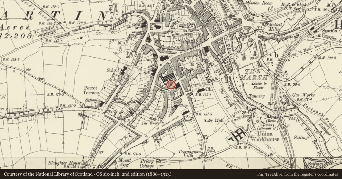
On the NW side of Hill Street some 50m from its junction with Market Street.
History
Former Three Crowns Inn, marked as an inn on 1888 OS. Earlier C19 late Georgian style front to earlier building. Continuous roof with Nos 13-15 to left, slightly higher than Nos 7-9 to right.
Exterior
Public House, painted stucco and roughcast with close-eaved slate roof and brick end stacks. Two storeys, three-window range offset to right: Stucco ground floor with band at first floor sill level and roughcast above. Windows in plain raised shouldered surrounds, all renewed 16-pane sashes. Recessed central C20 door (formerly 6-panel) in plain chamfered and stopped raised surround with moulded cornice above on scrolled console brackets (as on No 9). C20 4-panel door at extreme left to through passage (formerly a boarded door).
Interior
Interior opened out, but ground floor left room retains a C17 chamfered beam with ogee stops. Small fireplace on rear wall. Two pine beams in rear wing.
Reason for designation
Included for its special interest as a late Georgian front probably to an older building.
Nearby in the register
- 9 Hill StreetDomesticunder 1 mi
- Nos 13 and 15Domesticunder 1 mi
- 7 Hill StreetDomesticunder 1 mi
- 4 Hill StreetCommercialunder 1 mi
Other entries of the same register within about three miles of this one, by straight line.