Cof Cymru: National Historic Assets of Wales · Wales
18 Regent Street
Llangollen, Denbighshire, Wales
A Grade II listed building in Llangollen, Denbighshire, designated on 22 December 1989.
The record
- Designation
- Listed building, Grade II
- Broad class
- Commercial
- Date of designation
- 22 December 1989
- Community
- Llangollen
- Unitary authority
- Denbighshire
- Country
- Wales
- Coordinates
- 52.96865, -3.16837
- Cadw reference
- 1213
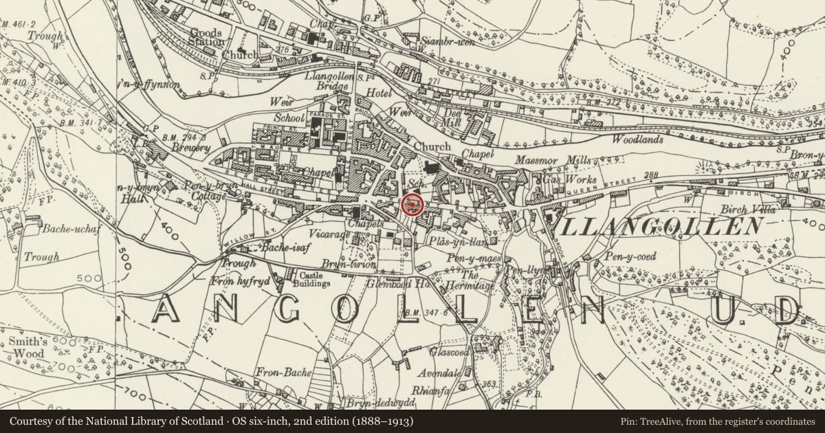
Slide toward Today to fade the historical sheet and see the modern map underneath.
David Rumsey Map Collection, Stanford LibrariesDavid Rumsey Map Collection, Stanford LibrariesDavid Rumsey Map Collection, Stanford LibrariesDavid Rumsey Map Collection, Stanford LibrariesLlyfrgell Genedlaethol Cymru – The National Library of Wales
5 historical maps cover this location, the earliest the 1795 map "To Sir Watkin Williams-Wynn Bart ... the map of the six counties of North Wales is most humbly inscribed by his obedient humble servant" (Llyfrgell Genedlaethol Cymru – The National Library of Wales).
Historical maps covering this location
- 1795 · To Sir Watkin Williams-Wynn Bart ... the map of the six counties of North Wales is most… (Llyfrgell Genedlaethol Cymru – The National Library of Wales)
- 1883 · Watershed map England, Wales 3. (David Rumsey Map Collection, Stanford Libraries)
- 1898 · 121 Wrexham (Hills) (David Rumsey Map Collection, Stanford Libraries)
- 1898 · 121 Wrexham (Outline) (David Rumsey Map Collection, Stanford Libraries)
- 1901 · Sheet 9 and 10. (David Rumsey Map Collection, Stanford Libraries)
Cadw's description
Location
Set into the street line towards the western end of the street.
History
Planned mid C19 terrace not shown on 1844 Tithe map.
Exterior
3 storey fronts of mottled red and yellow brick; similar brick chimney stacks, slate roof and plinth. 1 window fronts to Nos 12 to 18; 2 window. No 10 with cill band. Rendered lintels to mostly small pane sash windows; modern tripartite window to No 14 and modern window to rendered ground floor of No 10. Between Nos 12 and 14 is a narrow gated through passage to right of which is a contemporary shopfront with entrances flanking central window; dentil cornice, deep faceted entablature and large console brackets. Mostly 4 panel doors, part glazed to No 14 and with octagonal panels to the overlight of No 18. Right gable end is splayed back. Cross range to rear with some small pane sash windows.
Reason for designation
Included as the best example in the town of a relatively well preserved mid C19 planned terrace; also because of its shopfront.
Nearby in the register
- 16 Regent StreetCommercialunder 1 mi
- 14 Regent StreetCommercialunder 1 mi
- 12 Regent StreetCommercialunder 1 mi
- 10 Regent StreetCommercialunder 1 mi
Other entries of the same register within about three miles of this one, by straight line.