Cof Cymru: National Historic Assets of Wales · Wales
20 Goat Street
Haverfordwest, Pembrokeshire, Wales
A Grade II listed building in Haverfordwest, Pembrokeshire, designated on 1 July 1974.
The record
- Designation
- Listed building, Grade II
- Broad class
- Domestic
- Date of designation
- 1 July 1974
- Town
- Haverfordwest
- Community
- Haverfordwest
- Unitary authority
- Pembrokeshire
- Country
- Wales
- Coordinates
- 51.80083, -4.96901
- Cadw reference
- 12096
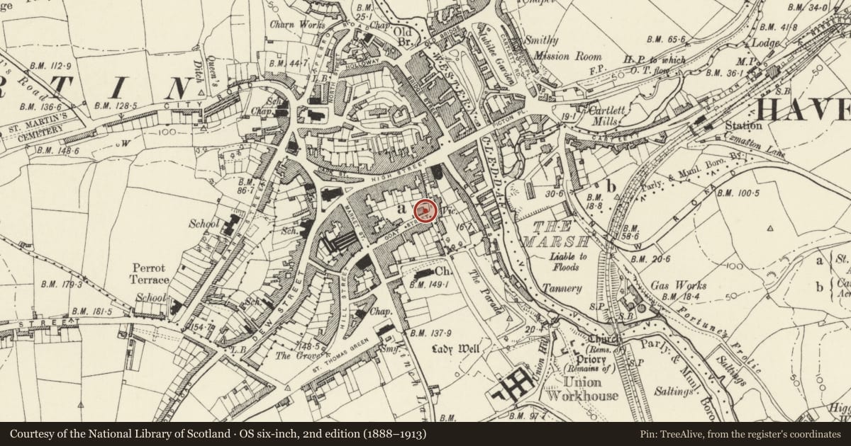
Slide toward Today to fade the historical sheet and see the modern map underneath.
David Rumsey Map Collection, Stanford LibrariesDavid Rumsey Map Collection, Stanford LibrariesDavid Rumsey Map Collection, Stanford LibrariesDavid Rumsey Map Collection, Stanford LibrariesDavid Rumsey Map Collection, Stanford Libraries
5 historical maps cover this location, the earliest the 1608 map "(13) Cambriae Typus." (David Rumsey Map Collection, Stanford Libraries).
Historical maps covering this location
- 1608 · (13) Cambriae Typus. (David Rumsey Map Collection, Stanford Libraries)
- 1636 · Cornubia : Devonia, Somersetus, Dorcestria, Wiltonia, Glocestria ... (David Rumsey Map Collection, Stanford Libraries)
- 1891 · Sheet 10. Ordnance Survey of England and Wales. . (David Rumsey Map Collection, Stanford Libraries)
- 1898 · 228 Haverfordwest (Hills) (David Rumsey Map Collection, Stanford Libraries)
- 1901 · Sheet 13. (David Rumsey Map Collection, Stanford Libraries)
Cadw's description
Location
Situated at lower end of steeply sloping terrace below Foley House.
History
End-terrace house, late C18 or early C19 with front altered in late C19 or early C20 when owned with No 18 by John Dawkins of Commerce House. Occupied in 1901 by Mrs Adams and the Rev. A. Thomas, curate, and by Charles Whittaker Parkes in 1926. The eaves cornice looks late C18 but may be a copy, the doorcase and windows look c1900-20.
Exterior
Terraced house, painted stucco with slate roof and right end stack. Delicate painted timber modillion eaves cornice, on broad raised band. Two storeys and attic, three-window range. Broad band under cornice, three plate glass first floor sashes, two broad ground floor windows each of two plate glass panes with two 6-pane top lights, and recessed central door. Unusual five-panel door with two arched panels, a horizontal mid-panel and two flush lower panels. Narrow small-paned overlight. Stuccoed c1900 doorcase with moulded shouldered architrave and pediment. Large gabled early C20 dormer with 9-pane centre light flanked by casements with weatherboarding above and bargeboards. Rubble stone right end wall with ... Rear has long stair-light to left with marginal panes (formerly with coloured glass) and added gabled wing to right.
Interior
Interior has tiled hall and rear right dog-leg stair with late Victorian or early C20 turned balusters and turned newels with ball finials. Closed string. Front left room has small timber chimney piece that may be late Georgian, with Victorian cast-iron grate.
Reason for designation
Included for its special interest as part of the terraced row Nos 14-20 Goat Street, with good late C19 or early C20 exterior detail.
Nearby in the register
- HillsideDomesticunder 1 mi
- No. 16 Goat Street and garage to leftDomesticunder 1 mi
- 23 Goat StreetDomesticunder 1 mi
- 23a Goat StreetDomesticunder 1 mi
Other entries of the same register within about three miles of this one, by straight line.