Cof Cymru: National Historic Assets of Wales · Wales
Poplar House
Llangollen, Denbighshire, Wales
A Grade II listed building in Llangollen, Denbighshire, designated on 22 December 1989.
The record
- Designation
- Listed building, Grade II
- Broad class
- Domestic
- Date of designation
- 22 December 1989
- Community
- Llangollen
- Unitary authority
- Denbighshire
- Country
- Wales
- Coordinates
- 52.96870, -3.16594
- Cadw reference
- 1204
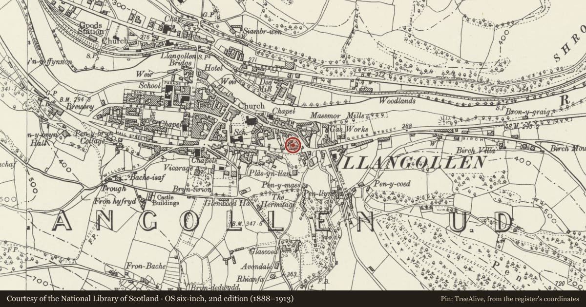
Slide toward Today to fade the historical sheet and see the modern map underneath.
David Rumsey Map Collection, Stanford LibrariesDavid Rumsey Map Collection, Stanford LibrariesDavid Rumsey Map Collection, Stanford LibrariesDavid Rumsey Map Collection, Stanford LibrariesLlyfrgell Genedlaethol Cymru – The National Library of Wales
5 historical maps cover this location, the earliest the 1795 map "To Sir Watkin Williams-Wynn Bart ... the map of the six counties of North Wales is most humbly inscribed by his obedient humble servant" (Llyfrgell Genedlaethol Cymru – The National Library of Wales).
Historical maps covering this location
- 1795 · To Sir Watkin Williams-Wynn Bart ... the map of the six counties of North Wales is most… (Llyfrgell Genedlaethol Cymru – The National Library of Wales)
- 1883 · Watershed map England, Wales 3. (David Rumsey Map Collection, Stanford Libraries)
- 1898 · 121 Wrexham (Hills) (David Rumsey Map Collection, Stanford Libraries)
- 1898 · 121 Wrexham (Outline) (David Rumsey Map Collection, Stanford Libraries)
- 1901 · Sheet 9 and 10. (David Rumsey Map Collection, Stanford Libraries)
Cadw's description
Location
Detached to left; near the E end of the street and the junction with Church Street. Gated access to left.
History
Earlier C18 - said to date from 1720; additions to rear. Renovation in progress at time of inspection (November 1988).
Exterior
Georgian, symmetrical 3-storey, 3-window painted roughcast front with plinth and quoins. Slate roof, wide boarded eaves and red brick end chimney stacks, larger to right. 12 and 16-pane flush frame sash windows with deep lintels to the 1st and ground floors. Earlier C19 glazing and doorcase with cornice, round arched opening and octagonally panelled reveals; half-glazed door and plain fanlight. Modern semicircular steps. Small cellar openings. Similar left hand side with cill bands. 16-pane sash to 2nd floor, 20 pane to 1st floor and tripartite small-pane to ground floor beside half-glazed door. Victorian 2-storey lean-to at rear with gabled porch.
Rubble kitchen chimney breast to rear and one Gothic window; modern alterations. Rubble right gable slightly cut back at rear.
Interior
Simple Georgian interior with narrow stairwell and hall; tapered newel with slightly swept up handrail. Imported panelled doors, also beams to Victorian range at rear. Cambered lintel to kitchen fireplace.
Reason for designation
Group value with Nos 43 to 49.
Nearby in the register
- 43 Regent StreetDomesticunder 1 mi
- 45 Regent StreetDomesticunder 1 mi
- 47 Regent StreetDomesticunder 1 mi
- The Sun Inn PHCommercialunder 1 mi
Other entries of the same register within about three miles of this one, by straight line.