Cof Cymru: National Historic Assets of Wales · Wales
No.1 (Sylvan)
Llangollen, Denbighshire, Wales
A Grade II listed building in Llangollen, Denbighshire, designated on 22 December 1989.
The record
- Designation
- Listed building, Grade II
- Broad class
- Commercial
- Date of designation
- 22 December 1989
- Community
- Llangollen
- Unitary authority
- Denbighshire
- Country
- Wales
- Coordinates
- 52.96894, -3.16943
- Cadw reference
- 1199
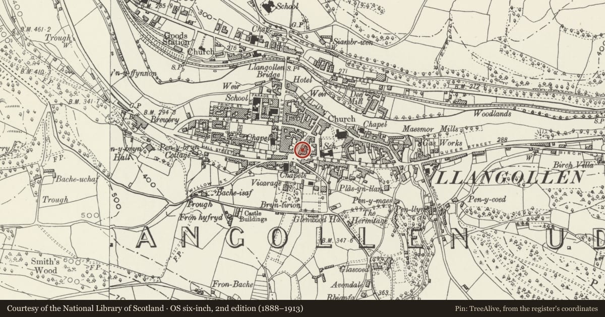
Slide toward Today to fade the historical sheet and see the modern map underneath.
David Rumsey Map Collection, Stanford LibrariesDavid Rumsey Map Collection, Stanford LibrariesDavid Rumsey Map Collection, Stanford LibrariesDavid Rumsey Map Collection, Stanford LibrariesLlyfrgell Genedlaethol Cymru – The National Library of Wales
5 historical maps cover this location, the earliest the 1795 map "To Sir Watkin Williams-Wynn Bart ... the map of the six counties of North Wales is most humbly inscribed by his obedient humble servant" (Llyfrgell Genedlaethol Cymru – The National Library of Wales).
Historical maps covering this location
- 1795 · To Sir Watkin Williams-Wynn Bart ... the map of the six counties of North Wales is most… (Llyfrgell Genedlaethol Cymru – The National Library of Wales)
- 1883 · Watershed map England, Wales 3. (David Rumsey Map Collection, Stanford Libraries)
- 1898 · 121 Wrexham (Hills) (David Rumsey Map Collection, Stanford Libraries)
- 1898 · 121 Wrexham (Outline) (David Rumsey Map Collection, Stanford Libraries)
- 1901 · Sheet 9 and 10. (David Rumsey Map Collection, Stanford Libraries)
Cadw's description
Location
Set back near the corner with Chapel Street, at a splayed angle to the road. No 15 Chapel Street forward to left creating iron forecourt to No 1.
History
Probably late C17/early C18 origins with early C19 heightening and rewindowing; some later alterations.
Exterior
2-storey 3-window painted roughcast front with slate roof, wide boarded eaves and central red brick chimney stack creating a lobby-entry plan to No 1. 2-windows to No 1, 1-window to No 2. The former has small pane casements to 1st floor (?later C19); almost flush frame 16 pane sashes to ground floor, also to 1st floor of No 2 altough this is recessed and has louvred shutters. No 1 has an off-centre bracket pedimented doorcase with 6-panel double doors. Modern splayed bay window to No 2 and modern glazed door to far right.
Higher cross range to rear of No 2.
Nearby in the register
- Blue Bay LaunderetteCommercialunder 1 mi
- 9 Chapel StreetCommercialunder 1 mi
- Pillar Box on the corner with Chapel St & Berwyn StCommunicationsunder 1 mi
- Reynard'sCommercialunder 1 mi
Other entries of the same register within about three miles of this one, by straight line.