Cof Cymru: National Historic Assets of Wales · Wales
6 Prospect Place
Llanelli, Carmarthenshire, Wales
A Grade II listed building in Llanelli, Carmarthenshire, designated on 12 March 1992.
The record
- Designation
- Listed building, Grade II
- Broad class
- Domestic
- Date of designation
- 12 March 1992
- Community
- Llanelli
- Unitary authority
- Carmarthenshire
- Country
- Wales
- Coordinates
- 51.68471, -4.15997
- Cadw reference
- 11954
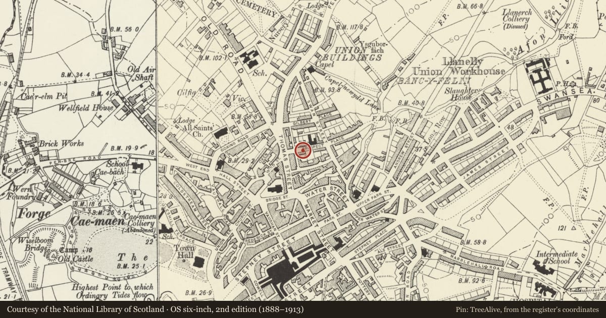
Slide toward Today to fade the historical sheet and see the modern map underneath.
David Rumsey Map Collection, Stanford LibrariesDavid Rumsey Map Collection, Stanford LibrariesDavid Rumsey Map Collection, Stanford LibrariesDavid Rumsey Map Collection, Stanford LibrariesDavid Rumsey Map Collection, Stanford Libraries
5 historical maps cover this location, the earliest the 1636 map "Cornubia : Devonia, Somersetus, Dorcestria, Wiltonia, Glocestria ..." (David Rumsey Map Collection, Stanford Libraries).
Historical maps covering this location
- 1636 · Cornubia : Devonia, Somersetus, Dorcestria, Wiltonia, Glocestria ... (David Rumsey Map Collection, Stanford Libraries)
- 1637 · The fourth table of England. Cornub. Devonia, Somerset etc. (David Rumsey Map Collection, Stanford Libraries)
- 1891 · Sheet 10. Ordnance Survey of England and Wales. . (David Rumsey Map Collection, Stanford Libraries)
- 1897 · 247 Swansea (Hills) (David Rumsey Map Collection, Stanford Libraries)
- 1920 · Sheet 100. Llanelly. (David Rumsey Map Collection, Stanford Libraries)
Cadw's description
Location
Terrace of 3 houses at west end of street, some 30 m from junction with ThomasáStreet.
History
Early to mid C19 terrace of 3 houses: No 2 the Cross Keys Inn, Nos 4 and 6 domestic, though No 6 was formerly an inn.
Exterior
Stucco with slate roofs and red brick east end stacks, 2 storeys 3 windows to each house stepped down slightly from next. Facades with cambered-headed arches reaching full-height from raised plinth (formerly with raised bands across pilasters at first floor level and remaining on No 4 only). Windows were sashes with slate sills: C20 replacement windows to No 2, plate glass sashes to No 4 and 4-pane sashes to No 6. No 2 has centre window (probably replacing door) No 4 has 5-panel door with overlight in rusticated stucco surround with keystone and No 6 has C20 door in circa 1930 raised stucco surround.
Reason for designation
Terrace is included in list as the best survivor of a distinctive Llanelli type of terraced house (Nos 1 to 13 opposite and Nos 3 to 17 Felinfoel Road nearby are more altered examples).
Nearby in the register
- 4 Prospect PlaceDomesticunder 1 mi
- 2 Prospect PlaceDomesticunder 1 mi
- Maltings at Former Buckley's BreweryIndustrialunder 1 mi
- including Railings and Front TerraceDomesticunder 1 mi
Other entries of the same register within about three miles of this one, by straight line.