Cof Cymru: National Historic Assets of Wales · Wales
Park Congregational School
Llanelli, Carmarthenshire, Wales
A Grade II listed building in Llanelli, Carmarthenshire, designated on 12 March 1992.
The record
- Designation
- Listed building, Grade II
- Broad class
- Religious, Ritual and Funerary
- Date of designation
- 12 March 1992
- Community
- Llanelli
- Unitary authority
- Carmarthenshire
- Country
- Wales
- Coordinates
- 51.67991, -4.16143
- Cadw reference
- 11922
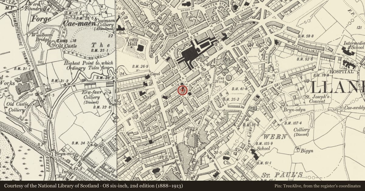
Slide toward Today to fade the historical sheet and see the modern map underneath.
David Rumsey Map Collection, Stanford LibrariesDavid Rumsey Map Collection, Stanford LibrariesNational Library of ScotlandDavid Rumsey Map Collection, Stanford LibrariesDavid Rumsey Map Collection, Stanford Libraries
5 historical maps cover this location, the earliest the 1636 map "Cornubia : Devonia, Somersetus, Dorcestria, Wiltonia, Glocestria ..." (David Rumsey Map Collection, Stanford Libraries).
Historical maps covering this location
- 1636 · Cornubia : Devonia, Somersetus, Dorcestria, Wiltonia, Glocestria ... (David Rumsey Map Collection, Stanford Libraries)
- 1637 · The fourth table of England. Cornub. Devonia, Somerset etc. (David Rumsey Map Collection, Stanford Libraries)
- 1891 · Sheet 10. Ordnance Survey of England and Wales. . (David Rumsey Map Collection, Stanford Libraries)
- 1920 · Sheet 100. Llanelly. (David Rumsey Map Collection, Stanford Libraries)
- 1963 · Map No. 4 - Local Government Commission for Wales : [Definitive maps showing proposed… (National Library of Scotland)
Cadw's description
Location
Situated to rear of Park Chapel, facing down Ralph Street.
Exterior
1889 Sunday School by Lander and Bedells of London (plaque) in squared tooled blue lias stone with Bath stone dressings, single storey with high octagonal slate roof. Cruciform plan with coped shouldered projecting gables to cardinal faces over plate-traceried 3-light windows. Intermediate diagonal low walls with sloping roof up to band of lantern lights, 8-sided, and steep bell-cast octagonal roof above.
In south west angle a low range runs west with gabled south door and coped parapet to right over 4-light mullion window.
Interior
Single large octagonal space with boarded roofs. Big sling braces to roof trusses rising from low corbels and cross-beams across gable openings with whalebone braces above.
Reason for designation
Included in list for distinctive octagonal shape and internal roof structure.
Nearby in the register
- Park Congregational Chapel, including enclosure railingsReligious, Ritual and Funeraryunder 1 mi
- Greenfield Baptist Chapel,Including Gates & Railings To EnclosureReligious, Ritual and Funeraryunder 1 mi
- The Midland BankCommercialunder 1 mi
- The Post OfficeCommunicationsunder 1 mi
Other entries of the same register within about three miles of this one, by straight line.