Cof Cymru: National Historic Assets of Wales · Wales
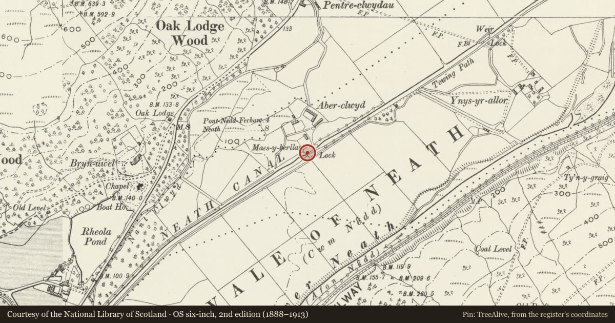
Aber-clwyd bridge over Neath Canal
Glynneath, Neath Port Talbot, Wales
A Grade II listed building in Glynneath, Neath Port Talbot, designated on 28 March 1990.
The record
- Designation
- Listed building, Grade II
- Broad class
- Transport
- Date of designation
- 28 March 1990
- Community
- Glynneath
- Unitary authority
- Neath Port Talbot
- Country
- Wales
- Coordinates
- 51.72769, -3.66734
- Cadw reference
- 11856
Slide toward Today to fade the historical sheet and see the modern map underneath.
David Rumsey Map Collection, Stanford LibrariesDavid Rumsey Map Collection, Stanford LibrariesDavid Rumsey Map Collection, Stanford LibrariesDavid Rumsey Map Collection, Stanford LibrariesDavid Rumsey Map Collection, Stanford Libraries
5 historical maps cover this location, the earliest the 1636 map "Cornubia : Devonia, Somersetus, Dorcestria, Wiltonia, Glocestria ..." (David Rumsey Map Collection, Stanford Libraries).
Historical maps covering this location
- 1636 · Cornubia : Devonia, Somersetus, Dorcestria, Wiltonia, Glocestria ... (David Rumsey Map Collection, Stanford Libraries)
- 1637 · The fourth table of England. Cornub. Devonia, Somerset etc. (David Rumsey Map Collection, Stanford Libraries)
- 1830 · V.3:11-15:XV. Britisches Reich. A. Kon: England. b. Frstenthum Wales: Shire: 37-40 (David Rumsey Map Collection, Stanford Libraries)
- 1865 · England and Wales. England No. 6. (David Rumsey Map Collection, Stanford Libraries)
- 1898 · 231 Merthyr Tydfil (Hills) (David Rumsey Map Collection, Stanford Libraries)
Cadw's description
Location
Situated on the Neath Canal between Resolven and Glynneath some 100m S of Aber-clwyd.
History
Late C18 tail-lock bridge refurbished c 1980 as part of the restoration of four miles of the Neath Canal from Resolven to Yscwrfa Bridge. The canal was originally planned from Pontneddfechan to Neath and was started in 1791 with Thomas Dadford Junior as General Surveyor. Thomas Sheasby replaced him in mid 1792 and the Neath Canal was completed in 1795. By 1799 the canal had been extended to the Giant's Grave near Briton Ferry.
Exterior
Canal bridge built into lock, coursed rubble stone with segmental arch of dressed stone voussoirs. Parapets to SW elevation are slightly splayed out each end to square piers and have cement slab copings. Parapets to NE elevation are shorter and have similar copings
Reason for designation
Listed for its special historic interest as a tail-lock bridge retaining its character on this important C18 canal. Group value with the adjacent lock and overflow.
Nearby in the register
- Aber-clwyd lock and overflow on Neath CanalTransportunder 1 mi
- Milestone on B4242 near Oak LodgeTransportunder 1 mi
- Pentreclwydau CollieryCollieryunder 1 mi
- Icehouse at Rheola HouseDomesticunder 1 mi
Other entries of the same register within about three miles of this one, by straight line.