Cof Cymru: National Historic Assets of Wales · Wales
Jersey Marine Tower
Coedffranc, Neath Port Talbot, Wales
A Grade II listed building in Jersey Marine, Coedffranc, Neath Port Talbot, designated on 26 September 1985.
The record
- Designation
- Listed building, Grade II
- Broad class
- Domestic
- Date of designation
- 26 September 1985
- Locality
- Jersey Marine
- Community
- Coedffranc
- Unitary authority
- Neath Port Talbot
- Country
- Wales
- Coordinates
- 51.62730, -3.86060
- Cadw reference
- 11846
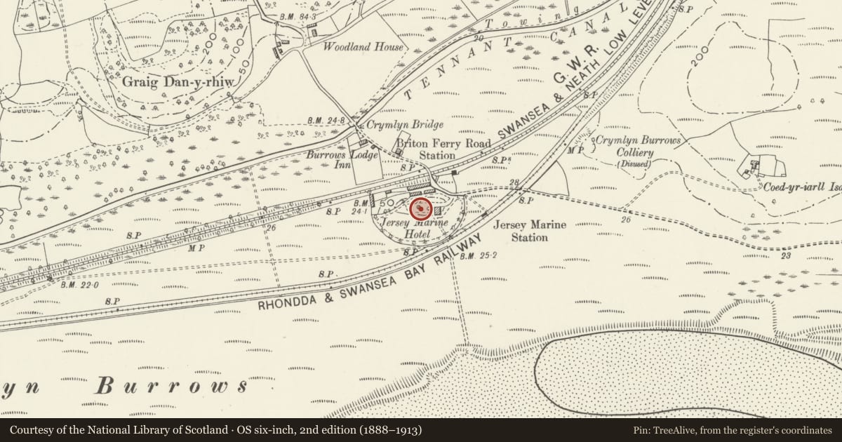
Slide toward Today to fade the historical sheet and see the modern map underneath.
David Rumsey Map Collection, Stanford LibrariesDavid Rumsey Map Collection, Stanford LibrariesDavid Rumsey Map Collection, Stanford LibrariesDavid Rumsey Map Collection, Stanford LibrariesDavid Rumsey Map Collection, Stanford Libraries
5 historical maps cover this location, the earliest the 1636 map "Cornubia : Devonia, Somersetus, Dorcestria, Wiltonia, Glocestria ..." (David Rumsey Map Collection, Stanford Libraries).
Historical maps covering this location
- 1636 · Cornubia : Devonia, Somersetus, Dorcestria, Wiltonia, Glocestria ... (David Rumsey Map Collection, Stanford Libraries)
- 1637 · The fourth table of England. Cornub. Devonia, Somerset etc. (David Rumsey Map Collection, Stanford Libraries)
- 1865 · England and Wales. England No. 6. (David Rumsey Map Collection, Stanford Libraries)
- 1891 · Sheet 10. Ordnance Survey of England and Wales. . (David Rumsey Map Collection, Stanford Libraries)
- 1897 · 247 Swansea (Hills) (David Rumsey Map Collection, Stanford Libraries)
Cadw's description
Location
On high ground S of the New Tower Hotel, W of the B4290.
History
Built by 1867 to support a camera obscura. The Jersey Marine Hotel adjoining the Tower was demolished in 1965.
Exterior
The octagonal 4-stage tower survives as roofless shell. It is built of red brick with rusticated quoins of larger yellow bricks (some replaced in stone), and yellow brick dressings with stone keys and sills to the openings. On the E and W sides there are segmental-headed doorways in the lower stage, with segmental-headed windows in the other faces. The lower-stage openings have all been infilled. The middle stages also have segmental-headed windows while the upper stage has taller round-headed windows with key and impost blocks. The castellated crown projects on a moulded corbel table and is of banded red and yellow bricks. It has tall merlons with moulded copings.
Interior
The interior is now inaccessible, but retains some plaster to the walls and the joist sockets of the former upper floors. The first floor has a wooden chimneypiece on the N side.
Reason for designation
Listed as an eye-catcher folly in a prominent location.
Nearby in the register
- St Margaret's ChapelChurchunder 1 mi
- Gelli-Bwch Round CairnRound Cairnunder 1 mi
- Weir on E side of Tennant Canal at Red Jacket PillTransportunder 1 mi
- River Lock and attached bridges at Red Jacket PillTransport1 mi
Other entries of the same register within about three miles of this one, by straight line.