Cof Cymru: National Historic Assets of Wales · Wales
24 Church Street
Neath, Neath Port Talbot, Wales
A Grade II listed building in Neath, Neath Port Talbot, designated on 6 May 1981.
The record
- Designation
- Listed building, Grade II
- Broad class
- Commercial
- Date of designation
- 6 May 1981
- Community
- Neath
- Unitary authority
- Neath Port Talbot
- Country
- Wales
- Coordinates
- 51.66419, -3.80368
- Cadw reference
- 11812
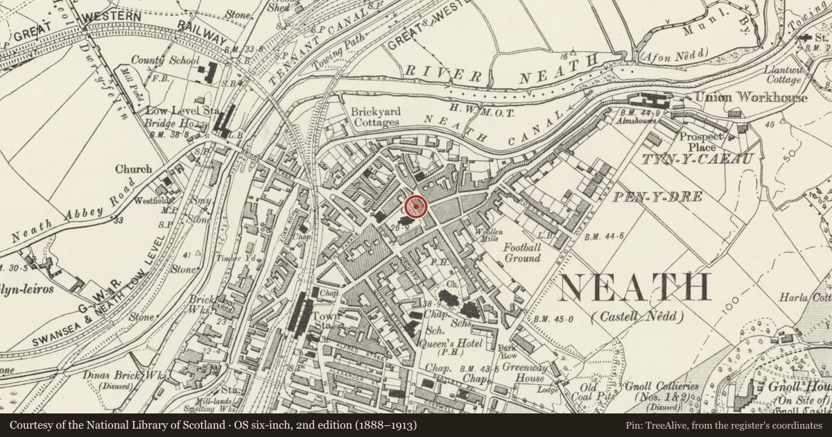
Slide toward Today to fade the historical sheet and see the modern map underneath.
David Rumsey Map Collection, Stanford LibrariesDavid Rumsey Map Collection, Stanford LibrariesDavid Rumsey Map Collection, Stanford LibrariesDavid Rumsey Map Collection, Stanford LibrariesDavid Rumsey Map Collection, Stanford Libraries
5 historical maps cover this location, the earliest the 1636 map "Cornubia : Devonia, Somersetus, Dorcestria, Wiltonia, Glocestria ..." (David Rumsey Map Collection, Stanford Libraries).
Historical maps covering this location
- 1636 · Cornubia : Devonia, Somersetus, Dorcestria, Wiltonia, Glocestria ... (David Rumsey Map Collection, Stanford Libraries)
- 1637 · The fourth table of England. Cornub. Devonia, Somerset etc. (David Rumsey Map Collection, Stanford Libraries)
- 1865 · England and Wales. England No. 6. (David Rumsey Map Collection, Stanford Libraries)
- 1891 · Sheet 10. Ordnance Survey of England and Wales. . (David Rumsey Map Collection, Stanford Libraries)
- 1897 · 247 Swansea (Hills) (David Rumsey Map Collection, Stanford Libraries)
Cadw's description
Location
On the street line opposite the junction with High Street.
History
Circa 1800 but with possible earlier origins.
Exterior
Three-storey and cellar, 3 window, colour washed roughcast, plastered plinth. Pitch daubed, gently pitched slate roof, plain eaves. Brick end stacks.
Asymmetric elevation with 2 windows grouped over to left. Blocked windows to second floor, stone sills. Victorian sash windows to first floor plain reveals, stone sills.
Sixteen pane horned sash window to ground floor left, cellar window below. Later C19 shop front from centre to right end. Hood with modilions on console brackets, plain pilasters. Recessed pair of doorways up steps, panelled door to left, half glazed double doors to right, rounded heads, shallow 5 light bar room window to right, rounded heads. Large vaulted brick cellars. Some ceiling beams show evidence of earlier origins/re-use.
Two-storey, 3 window roughcast range to rear facing Church Place. Slate roof, tall brick stack to right and Victorian sashes to first floor, bipartite to right. Later fenestration and doorway to ground floor.
Reason for designation
Group value with other listed items on Old Market Street.
Nearby in the register
- The St Ives Public HouseCommercialunder 1 mi
- Adrian Hicks & SonCommercialunder 1 mi
- 6 Old Market StreetCommercialunder 1 mi
- 7 Market StreetCommercialunder 1 mi
Other entries of the same register within about three miles of this one, by straight line.