Cof Cymru: National Historic Assets of Wales · Wales
Bethania Baptist Chapel
Neath, Neath Port Talbot, Wales
A Grade II listed building in Neath, Neath Port Talbot, designated on 5 January 1989.
The record
- Designation
- Listed building, Grade II
- Broad class
- Religious, Ritual and Funerary
- Date of designation
- 5 January 1989
- Community
- Neath
- Unitary authority
- Neath Port Talbot
- Country
- Wales
- Coordinates
- 51.66062, -3.80432
- Cadw reference
- 11799
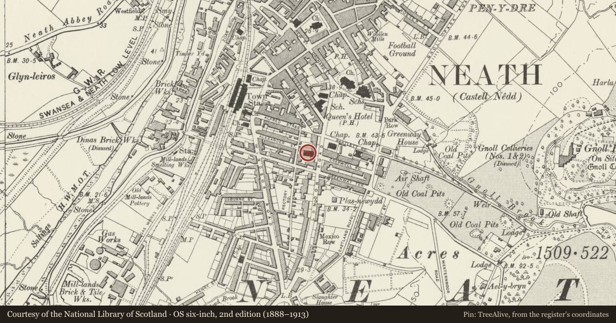
Slide toward Today to fade the historical sheet and see the modern map underneath.
David Rumsey Map Collection, Stanford LibrariesDavid Rumsey Map Collection, Stanford LibrariesDavid Rumsey Map Collection, Stanford LibrariesDavid Rumsey Map Collection, Stanford LibrariesDavid Rumsey Map Collection, Stanford Libraries
5 historical maps cover this location, the earliest the 1636 map "Cornubia : Devonia, Somersetus, Dorcestria, Wiltonia, Glocestria ..." (David Rumsey Map Collection, Stanford Libraries).
Historical maps covering this location
- 1636 · Cornubia : Devonia, Somersetus, Dorcestria, Wiltonia, Glocestria ... (David Rumsey Map Collection, Stanford Libraries)
- 1637 · The fourth table of England. Cornub. Devonia, Somerset etc. (David Rumsey Map Collection, Stanford Libraries)
- 1865 · England and Wales. England No. 6. (David Rumsey Map Collection, Stanford Libraries)
- 1891 · Sheet 10. Ordnance Survey of England and Wales. . (David Rumsey Map Collection, Stanford Libraries)
- 1897 · 247 Swansea (Hills) (David Rumsey Map Collection, Stanford Libraries)
Cadw's description
Location
Behind a railed forecourt opposite the junction with Creswell Road.
History
1862.
Exterior
Three bay classical front. Squared rubble laid to courses, gently pitched slate roof. Pediment with roundel in the form of a belt with chape. Lettering to belt reads BETHANY date 1862 by chape. BAPTIST CHAPEL to centre. Plain frieze, simple architrave. Four Tuscan pilasters, outer ones set in from corners with regular stressed quoins. Plinth. Tall round arched windows to outer bays. Moulded keystoned arch with impost band, plain architrave on bracket below sill band . Sash windows with marginal glazing bars, small panes. Similar detail Venetian window in broader centre bay. Broad flat topped porch, paired Tuscan columns to outer corners. Broad doorway, stressed regular quoins. Modern double doors.
Plain 3 window rendered side elevations. Plain eaves cornice, end pilaters. Tall round arched windows, glazing as to front, continuous sill band.
Railed forecourt with double gates to centre, paved path to porch.
Nearby in the register
- Pillar BoxCommunicationsunder 1 mi
- Neath LibraryCivilunder 1 mi
- Masonic TempleInstitutionalunder 1 mi
- 52 Windsor RoadDomesticunder 1 mi
Other entries of the same register within about three miles of this one, by straight line.