Cof Cymru: National Historic Assets of Wales · Wales
61 Wind Street
Castle, Swansea, Wales
A Grade II listed building in Castle, Swansea, designated on 30 March 1987.
The record
- Designation
- Listed building, Grade II
- Broad class
- Commercial
- Date of designation
- 30 March 1987
- Community
- Castle
- Unitary authority
- Swansea
- Country
- Wales
- Coordinates
- 51.61938, -3.94079
- Cadw reference
- 11671
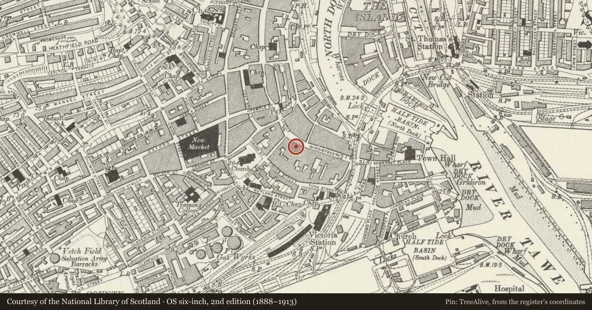
Slide toward Today to fade the historical sheet and see the modern map underneath.
David Rumsey Map Collection, Stanford LibrariesDavid Rumsey Map Collection, Stanford LibrariesDavid Rumsey Map Collection, Stanford LibrariesDavid Rumsey Map Collection, Stanford LibrariesDavid Rumsey Map Collection, Stanford Libraries
5 historical maps cover this location, the earliest the 1636 map "Cornubia : Devonia, Somersetus, Dorcestria, Wiltonia, Glocestria ..." (David Rumsey Map Collection, Stanford Libraries).
Historical maps covering this location
- 1636 · Cornubia : Devonia, Somersetus, Dorcestria, Wiltonia, Glocestria ... (David Rumsey Map Collection, Stanford Libraries)
- 1637 · The fourth table of England. Cornub. Devonia, Somerset etc. (David Rumsey Map Collection, Stanford Libraries)
- 1865 · England and Wales. England No. 6. (David Rumsey Map Collection, Stanford Libraries)
- 1891 · Sheet 10. Ordnance Survey of England and Wales. . (David Rumsey Map Collection, Stanford Libraries)
- 1897 · 247 Swansea (Hills) (David Rumsey Map Collection, Stanford Libraries)
Cadw's description
Location
Part of a Georgian group on the curve of the street leading up to the Castle.
Exterior
Narrow early C19 3 storey painted brick frontage between taller frontages. Slate roof, eaves with paired brackets, brick pilasters. One sash window per storey, upper glazing bars only. Overall fascia to pilastered shop front with triple arched glazing; linked to fascia of No 62 on right.
Reason for designation
Included for group value.
Nearby in the register
- 62 Wind StreetCommercialunder 1 mi
- The Coach HouseDomesticunder 1 mi
- Barclays BankCommercialunder 1 mi
- No Sign Bar & Munday's Wine MerchantsCommercialunder 1 mi
Other entries of the same register within about three miles of this one, by straight line.