Cof Cymru: National Historic Assets of Wales · Wales
Old Post Office Building (Now Post Office Sorting Office)
Castle, Swansea, Wales
A Grade II listed building in Swansea, Castle, designated on 30 March 1987.
The record
- Designation
- Listed building, Grade II
- Broad class
- Communications
- Date of designation
- 30 March 1987
- Locality
- Swansea
- Community
- Castle
- Unitary authority
- Swansea
- Country
- Wales
- Coordinates
- 51.61956, -3.94007
- Cadw reference
- 11660
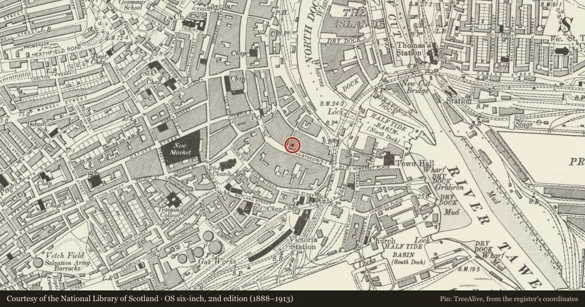
Slide toward Today to fade the historical sheet and see the modern map underneath.
David Rumsey Map Collection, Stanford LibrariesDavid Rumsey Map Collection, Stanford LibrariesDavid Rumsey Map Collection, Stanford LibrariesDavid Rumsey Map Collection, Stanford LibrariesDavid Rumsey Map Collection, Stanford Libraries
5 historical maps cover this location, the earliest the 1636 map "Cornubia : Devonia, Somersetus, Dorcestria, Wiltonia, Glocestria ..." (David Rumsey Map Collection, Stanford Libraries).
Historical maps covering this location
- 1636 · Cornubia : Devonia, Somersetus, Dorcestria, Wiltonia, Glocestria ... (David Rumsey Map Collection, Stanford Libraries)
- 1637 · The fourth table of England. Cornub. Devonia, Somerset etc. (David Rumsey Map Collection, Stanford Libraries)
- 1865 · England and Wales. England No. 6. (David Rumsey Map Collection, Stanford Libraries)
- 1891 · Sheet 10. Ordnance Survey of England and Wales. . (David Rumsey Map Collection, Stanford Libraries)
- 1897 · 247 Swansea (Hills) (David Rumsey Map Collection, Stanford Libraries)
Cadw's description
History
1898-1901. Designed by "a government architect"; David Jenkins & Sons, contractors; enlargements to building 1916 and 1924.
Exterior
Jacobethan style, detailing much simplified to Wind Street. Symmetrical 3 storey attic and basement ashlar front (heavily cemented), twin advanced gabled bays flank narrow entrance bay with porch. High slated roof with 2-stage openwork classical cupola and weathervane. Steep, partly shaped gables with pedimented tops, ball-finials over attached granite columns to attic windows. Moulded cornice and parapets, clasping pilaster treatment to angles, faceted strips to 1st and 2nd floors, moulded cill and cornice bands.
1 and 2-light mullioned windows (grouped 1-3-1-3-1), small oculus ground floor left. Enriched 4-bay ground floor right with arched windows, swags, winged heads and mythological spandrel figures. Porch with Royal Arms to aedicule set in pediment, doorpiece with granite columns and surround (much simplified capitals and entablature), double panelled doors. Good area railings.
Massive side elevation to lane with advanced gabled centre topped by pilastered chimney, detailing as before. Ground floor cartouches with "VR". Left hand stair tower with ovoid upper lights. Long 3 storey and basement pilastered extension in yellow brick runs through to gable end facing Strand.
Reason for designation
Group value.
Nearby in the register
- Telecom BuildingCommercialunder 1 mi
- National Bank LtdCommercialunder 1 mi
- National Bank LtdCommercialunder 1 mi
- Liverpool Victoria Insurance Offices Including "Cane Connection" ShopCommercialunder 1 mi
Other entries of the same register within about three miles of this one, by straight line.