Cof Cymru: National Historic Assets of Wales · Wales
Churchyard Wall to N.of st. Collen's Parish Church, Including Gated Entry
Llangollen, Denbighshire, Wales
A Grade II listed building in Llangollen, Denbighshire, designated on 22 December 1989.
The record
- Designation
- Listed building, Grade II
- Broad class
- Religious, Ritual and Funerary
- Date of designation
- 22 December 1989
- Community
- Llangollen
- Unitary authority
- Denbighshire
- Country
- Wales
- Coordinates
- 52.96959, -3.16792
- Cadw reference
- 1163
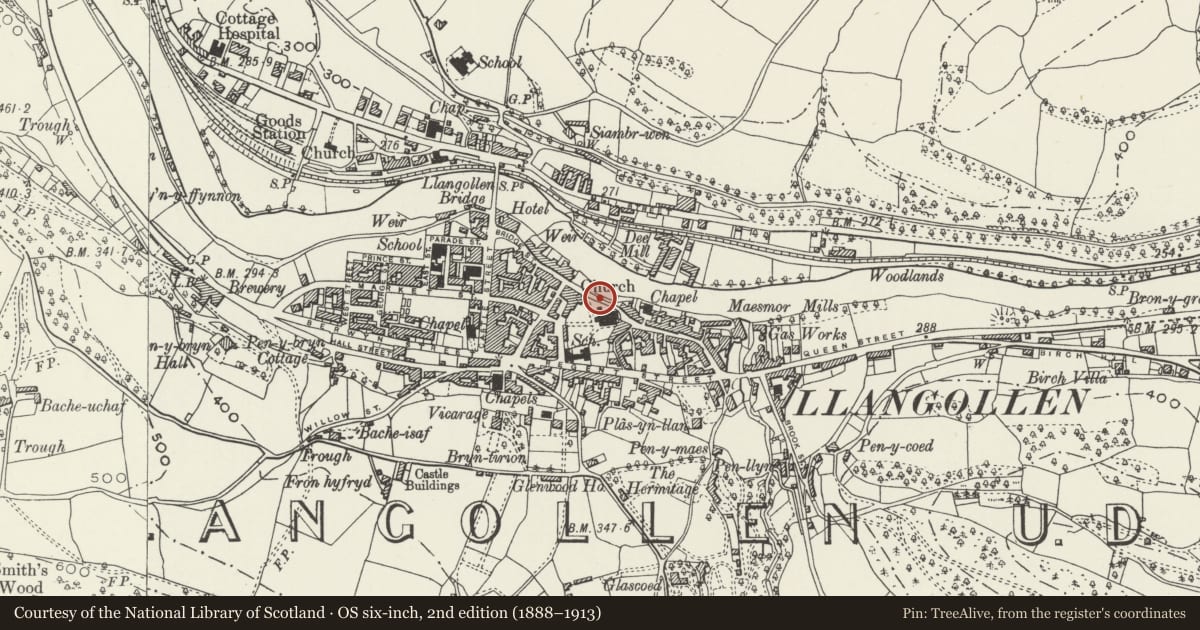
Slide toward Today to fade the historical sheet and see the modern map underneath.
David Rumsey Map Collection, Stanford LibrariesDavid Rumsey Map Collection, Stanford LibrariesDavid Rumsey Map Collection, Stanford LibrariesDavid Rumsey Map Collection, Stanford LibrariesLlyfrgell Genedlaethol Cymru – The National Library of Wales
5 historical maps cover this location, the earliest the 1795 map "To Sir Watkin Williams-Wynn Bart ... the map of the six counties of North Wales is most humbly inscribed by his obedient humble servant" (Llyfrgell Genedlaethol Cymru – The National Library of Wales).
Historical maps covering this location
- 1795 · To Sir Watkin Williams-Wynn Bart ... the map of the six counties of North Wales is most… (Llyfrgell Genedlaethol Cymru – The National Library of Wales)
- 1883 · Watershed map England, Wales 3. (David Rumsey Map Collection, Stanford Libraries)
- 1898 · 121 Wrexham (Hills) (David Rumsey Map Collection, Stanford Libraries)
- 1898 · 121 Wrexham (Outline) (David Rumsey Map Collection, Stanford Libraries)
- 1901 · Sheet 9 and 10. (David Rumsey Map Collection, Stanford Libraries)
Cadw's description
Location
N boundary to pentagonal shaped churchyard bordered by Church Street, Hand Hotel and the Medical Centre.
History
Possible C17 wall in origin with alterations in 1864-7 contemporary with the remodelling of the church by S pountney Smith. The course was slightly altered due to the addition of the chancel.
Exterior
Rubble with rounded coping. Follows the line of the road and returns at ends; rising to left (E) to adjoin the buttress below the chancel gable end and to right tnere is a gated entrance. Here the wall has been cut down in steps with spearhead railings. Octagonal cast iron gate piers at right angles, with openwork Gothic tracery and pyramidal caps; similar gates.
Reason for designation
Included for group value with the Parish Church and Hand Hotel.
Nearby in the register
- St.Collen's Parish ChurchReligious, Ritual and Funeraryunder 1 mi
- Bryn-DwrDomesticunder 1 mi
- Maesmawr HouseDomesticunder 1 mi
- Sundial in the churchyard of St. Collen's Parish ChurchGardens, Parks and Urban Spacesunder 1 mi
Other entries of the same register within about three miles of this one, by straight line.