Cof Cymru: National Historic Assets of Wales · Wales
H.M.Prison, Perimeter Walls
Castle, Swansea, Wales
A Grade II listed building in Castle, Swansea, designated on 11 February 1985.
The record
- Designation
- Listed building, Grade II
- Broad class
- Civil
- Date of designation
- 11 February 1985
- Community
- Castle
- Unitary authority
- Swansea
- Country
- Wales
- Coordinates
- 51.61549, -3.95016
- Cadw reference
- 11607
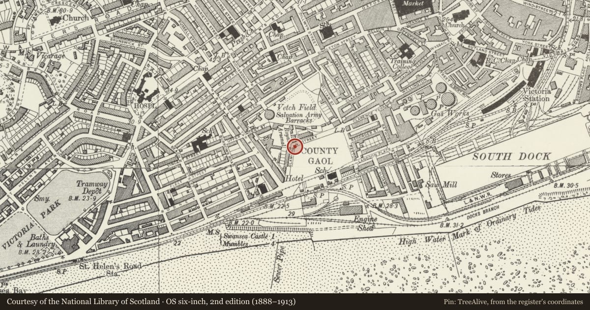
Slide toward Today to fade the historical sheet and see the modern map underneath.
David Rumsey Map Collection, Stanford LibrariesDavid Rumsey Map Collection, Stanford LibrariesDavid Rumsey Map Collection, Stanford LibrariesDavid Rumsey Map Collection, Stanford LibrariesDavid Rumsey Map Collection, Stanford Libraries
5 historical maps cover this location, the earliest the 1636 map "Cornubia : Devonia, Somersetus, Dorcestria, Wiltonia, Glocestria ..." (David Rumsey Map Collection, Stanford Libraries).
Historical maps covering this location
- 1636 · Cornubia : Devonia, Somersetus, Dorcestria, Wiltonia, Glocestria ... (David Rumsey Map Collection, Stanford Libraries)
- 1637 · The fourth table of England. Cornub. Devonia, Somerset etc. (David Rumsey Map Collection, Stanford Libraries)
- 1865 · England and Wales. England No. 6. (David Rumsey Map Collection, Stanford Libraries)
- 1891 · Sheet 10. Ordnance Survey of England and Wales. . (David Rumsey Map Collection, Stanford Libraries)
- 1897 · 247 Swansea (Hills) (David Rumsey Map Collection, Stanford Libraries)
Cadw's description
Location
Gatehouse set back from the line of the high perimeter wall with access road flanked by low curved forecourt walls.
History
Dating from 1861 when the entire prison was rebuilt and enlarged (cost over £30,000).
Exterior
Nearly symmetrical 2-storey L-shaped blocks (formerly with Chief Gaoler’s and Governor’s residence) flank the recessed 2 storey arched entry. Snecked rubble facings, freestone dressings, hipped slate roofs, tall stacks with cornices, wide eaves with moulded cornices, plain frieze, sunk roll mouldings to outer angles, projecting plinth. Archway surmounted by cornice with heavy blocking course linked below to key block (with some rustication) splayed angle and rustication to arch head, bold 1st floor cill bands run back to imposts, massive double boarded doors with boarded lunette. Mostly paired windows in heavy rusticated surrounds with keyblocks, moulded imposts and aprons, upper floor round-headed, ground floor segmental headed.
Angle to left with lean-to addition; low curving range attached to left end. Lower 2 storey 3 bay range, with detailing as before plus eaves brackets, set back on right.
High snecked rubble perimeter wall with slight batter to Oystermouth Road, occasional vertical buttresses. Continues round Glamorgan and Paxton Streets.
Reason for designation
Robust Italianate classicism.
Nearby in the register
- H.M.Prison, Main Block (B.Wing)Civilunder 1 mi
- H.M.Prison, Main Block (A.Wing)Civilunder 1 mi
- H.M.Prison, Gatehouse BuildingCivilunder 1 mi
- Christ Church (Garrison Church of Swansea)Religious, Ritual and Funeraryunder 1 mi
Other entries of the same register within about three miles of this one, by straight line.