Cof Cymru: National Historic Assets of Wales · Wales
1 Southend Villas
Mumbles, Swansea, Wales
A Grade II listed building in Southend, Swansea, Mumbles, designated on 3 June 1964.
The record
- Designation
- Listed building, Grade II
- Broad class
- Domestic
- Date of designation
- 3 June 1964
- Locality
- Southend
- Town
- Swansea
- Community
- Mumbles
- Unitary authority
- Swansea
- Country
- Wales
- Coordinates
- 51.57148, -3.98806
- Cadw reference
- 11529
Slide toward Today to fade the historical sheet and see the modern map underneath.
David Rumsey Map Collection, Stanford LibrariesDavid Rumsey Map Collection, Stanford LibrariesDavid Rumsey Map Collection, Stanford LibrariesDavid Rumsey Map Collection, Stanford LibrariesDavid Rumsey Map Collection, Stanford Libraries
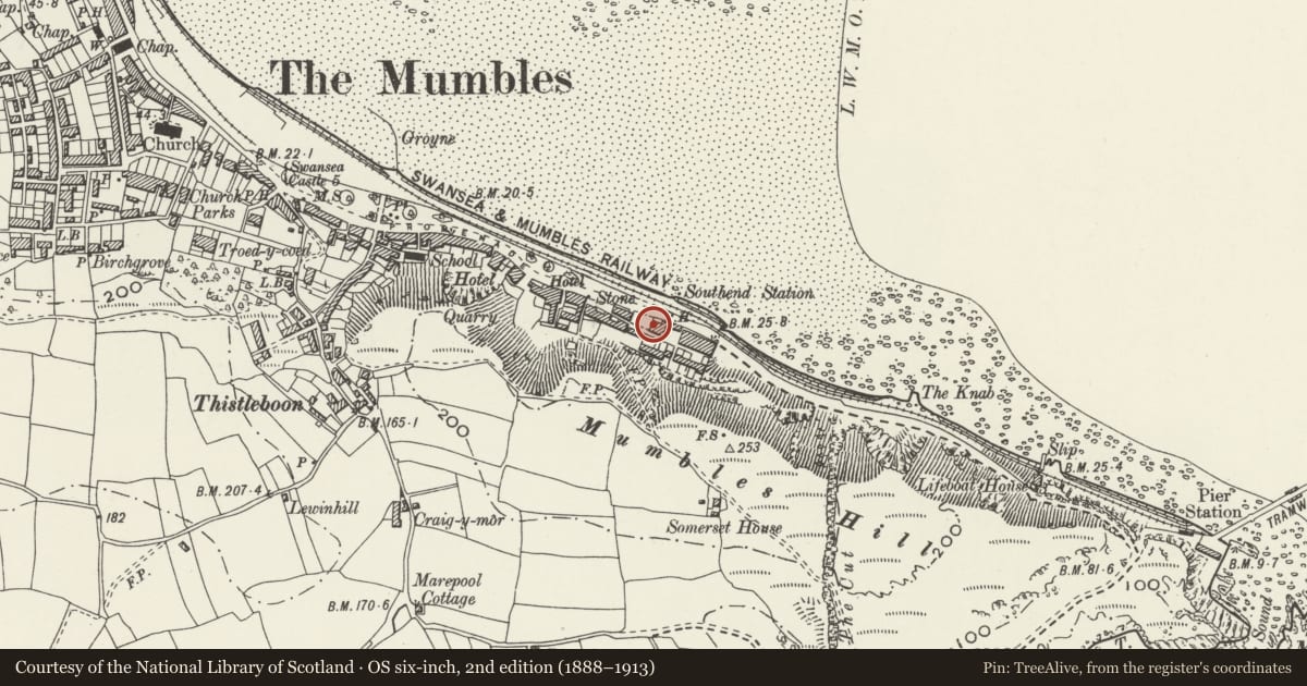
5 historical maps cover this location, the earliest the 1636 map "Cornubia : Devonia, Somersetus, Dorcestria, Wiltonia, Glocestria ..." (David Rumsey Map Collection, Stanford Libraries).
Historical maps covering this location
- 1636 · Cornubia : Devonia, Somersetus, Dorcestria, Wiltonia, Glocestria ... (David Rumsey Map Collection, Stanford Libraries)
- 1865 · England and Wales. England No. 6. (David Rumsey Map Collection, Stanford Libraries)
- 1891 · Sheet 10. Ordnance Survey of England and Wales. . (David Rumsey Map Collection, Stanford Libraries)
- 1897 · 247 Swansea (Hills) (David Rumsey Map Collection, Stanford Libraries)
- 1920 · Sheet 100. Llanelly. (David Rumsey Map Collection, Stanford Libraries)
Cadw's description
Location
Approximately 0.75km SE of Oystermouth church facing the sea front.
Interior
Number 1 occupies the lower storey of the original house.
Reason for designation
Listed as an early C19 villa, of a type once common on the W side of Swansea Bay, retaining original character.
Nearby in the register
- 2 Southend VillasDomesticunder 1 mi
- 3 Southend VillasDomesticunder 1 mi
- Turnpike Trust boundary stone in front of 704 Mumbles RoadCommunicationsunder 1 mi
- Bristol Channel Yacht ClubRecreationalunder 1 mi
Other entries of the same register within about three miles of this one, by straight line.