Cof Cymru: National Historic Assets of Wales · Wales
Newsagents
Llangollen, Denbighshire, Wales
A Grade II listed building in Llangollen, Denbighshire, designated on 22 December 1989.
The record
- Designation
- Listed building, Grade II
- Broad class
- Commercial
- Date of designation
- 22 December 1989
- Community
- Llangollen
- Unitary authority
- Denbighshire
- Country
- Wales
- Coordinates
- 52.96934, -3.16943
- Cadw reference
- 1150
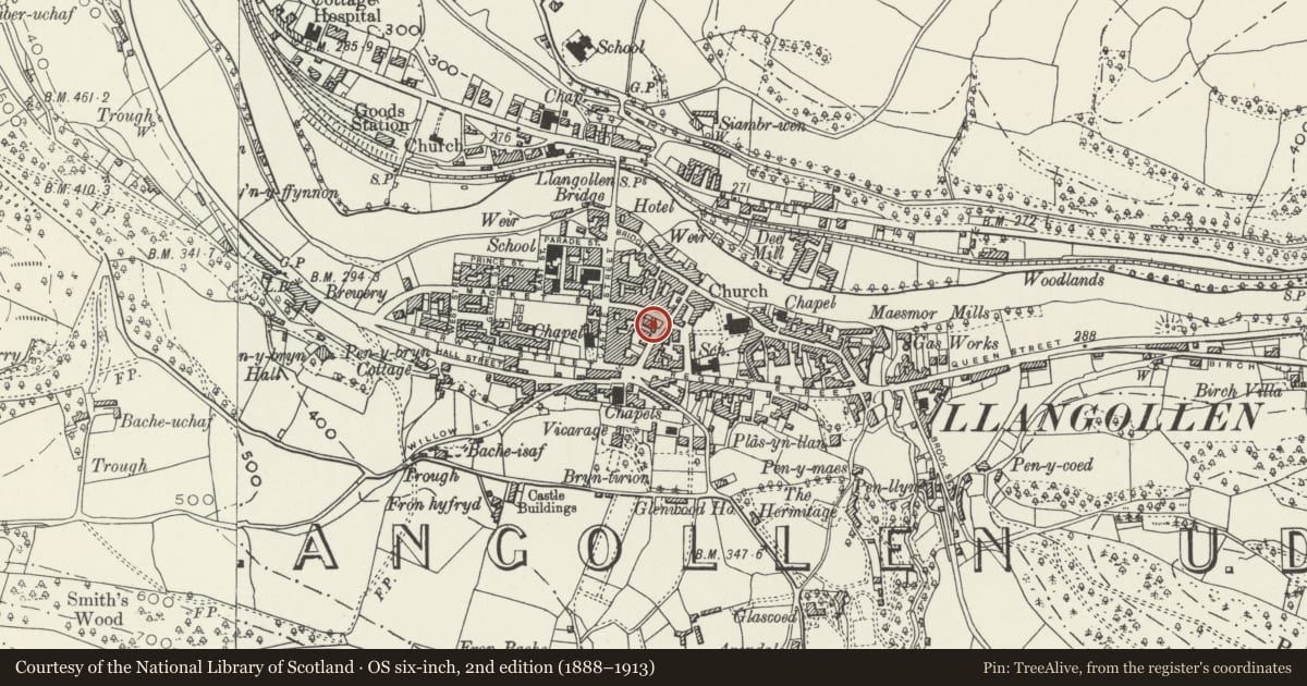
Slide toward Today to fade the historical sheet and see the modern map underneath.
David Rumsey Map Collection, Stanford LibrariesDavid Rumsey Map Collection, Stanford LibrariesDavid Rumsey Map Collection, Stanford LibrariesDavid Rumsey Map Collection, Stanford LibrariesLlyfrgell Genedlaethol Cymru – The National Library of Wales
5 historical maps cover this location, the earliest the 1795 map "To Sir Watkin Williams-Wynn Bart ... the map of the six counties of North Wales is most humbly inscribed by his obedient humble servant" (Llyfrgell Genedlaethol Cymru – The National Library of Wales).
Historical maps covering this location
- 1795 · To Sir Watkin Williams-Wynn Bart ... the map of the six counties of North Wales is most… (Llyfrgell Genedlaethol Cymru – The National Library of Wales)
- 1883 · Watershed map England, Wales 3. (David Rumsey Map Collection, Stanford Libraries)
- 1898 · 121 Wrexham (Hills) (David Rumsey Map Collection, Stanford Libraries)
- 1898 · 121 Wrexham (Outline) (David Rumsey Map Collection, Stanford Libraries)
- 1901 · Sheet 9 and 10. (David Rumsey Map Collection, Stanford Libraries)
Cadw's description
Location
Gabled front to road near the junction with Oak Street; rounded corner to left leads into Chapel Street Square.
History
Probably C16 timber framed structure in origin with C17 enlargements and C19 and modern alterations. Essentially a range, end on to the street, with cross range added near the rear and the corner to front infilled.
Exterior
2-storey front with rendered gable to right - mixture of applied black and white and original exposed truss. 2 light casement over modern shopfront. The slate roof sweeps up to left over rounded corner; this is whitewashed brick with applied timber. Curved 6-pane sash window over curved C19 3-light shop window with end pilasters. Diamond leaded window to rear of this corner block which links with a proably C17 cross range with gable to Chapel Street Square. The wall post is visible to left as are the bases of the principal rafters. Small pane sliding sash window to 1st floor and broad modern window below; modern door. Rubble right hand side.
Interior
Internally the tie and collar beam roof trusses are exposed with massive uncut and undulating purlins and queen struts. The purlins have probably been reused - see lower tenon sockets. One uncut beam to main ground floor room.
Reason for designation
Group value with Chapel Street Square and Nos 7 & 9 Chapel Street.
Nearby in the register
- 1 Chapel Street SquareDomesticunder 1 mi
- 2 Chapel Street SquareDomesticunder 1 mi
- 3 Chapel Street SquareDomesticunder 1 mi
- Reynard'sCommercialunder 1 mi
Other entries of the same register within about three miles of this one, by straight line.