Cof Cymru: National Historic Assets of Wales · Wales
Stables House
Dowlais, Merthyr Tydfil, Wales
A Grade II listed building in Dowlais, Merthyr Tydfil, designated on 22 May 1974.
The record
- Designation
- Listed building, Grade II
- Broad class
- Domestic
- Date of designation
- 22 May 1974
- Locality
- Dowlais
- Town
- Merthyr Tydfil
- Community
- Dowlais
- Unitary authority
- Merthyr Tydfil
- Country
- Wales
- Coordinates
- 51.76222, -3.35330
- Cadw reference
- 11477
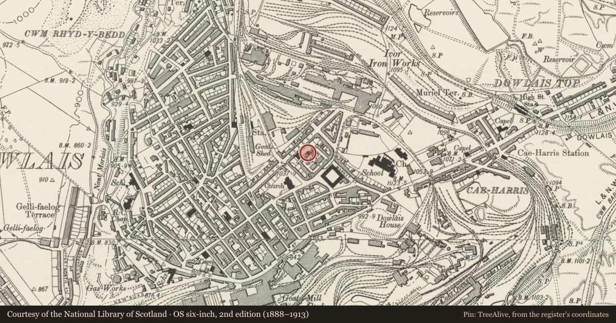
Slide toward Today to fade the historical sheet and see the modern map underneath.
David Rumsey Map Collection, Stanford LibrariesDavid Rumsey Map Collection, Stanford LibrariesDavid Rumsey Map Collection, Stanford LibrariesDavid Rumsey Map Collection, Stanford LibrariesDavid Rumsey Map Collection, Stanford Libraries
5 historical maps cover this location, the earliest the 1636 map "Cornubia : Devonia, Somersetus, Dorcestria, Wiltonia, Glocestria ..." (David Rumsey Map Collection, Stanford Libraries).
Historical maps covering this location
- 1636 · Cornubia : Devonia, Somersetus, Dorcestria, Wiltonia, Glocestria ... (David Rumsey Map Collection, Stanford Libraries)
- 1830 · V.3:11-15:XV. Britisches Reich. A. Kon: England. b. Frstenthum Wales: Shire: 37-40 (David Rumsey Map Collection, Stanford Libraries)
- 1856 · 42. Brecon. (David Rumsey Map Collection, Stanford Libraries)
- 1895 · Sheet 11. Ordnance Survey of England and Wales. (David Rumsey Map Collection, Stanford Libraries)
- 1898 · 231 Merthyr Tydfil (Hills) (David Rumsey Map Collection, Stanford Libraries)
Cadw's description
Location
Situated just to the NW and rear of Dowlais Works Stables between Upper Union Street and Ivor Street.
History
House, earlier C19, connected with Dowlais Works Stables.
Exterior
House, white-painted stucco with slate close-eaved roof and small rendered end stacks. Two-storeys, three-window range of 12-paned C20 windows, longer on ground floor. Centre C20 door with slightly cambered head (stuccoed architrave, 4-panel door and overlight removed since 1974). Painted stone window sills. One-storey range to left, former harness room and trap-shed, now converted, part in Stables House, the rest Stables Cottage. Door to extreme right, then 2 12-pane sashes and another door, and finally 3 well-spaced 12-pane sashes. C20 eaves roof.
Rear of house is stuccoed with centre stair light, and single-storey wing at right angles to right. Rear of cottage range is rubble stone.
Interior
Not inspected.
Reason for designation
Included for historical interest as an earlier C19 house connected with Dowlais Works stables.
Nearby in the register
- Ivor English Congregational Church including forecourt wallsReligious, Ritual and Funeraryunder 1 mi
- Dowlais Works StablesIndustrialunder 1 mi
- Church of St JohnReligious, Ritual and Funeraryunder 1 mi
- Dowlais Public LibraryEducationunder 1 mi
Other entries of the same register within about three miles of this one, by straight line.