Cof Cymru: National Historic Assets of Wales · Wales
St Tydfil's Hospital: Entrance Block (Centre Part Only)
Town, Merthyr Tydfil, Wales
A Grade II listed building in Town, Merthyr Tydfil, designated on 13 January 1988.
The record
- Designation
- Listed building, Grade II
- Broad class
- Health and Welfare
- Date of designation
- 13 January 1988
- Community
- Town
- Unitary authority
- Merthyr Tydfil
- Country
- Wales
- Coordinates
- 51.74794, -3.37589
- Cadw reference
- 11475
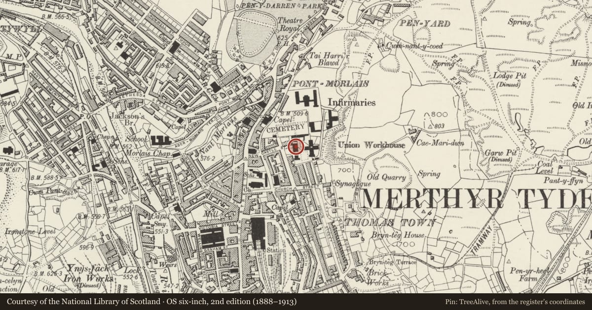
Slide toward Today to fade the historical sheet and see the modern map underneath.
David Rumsey Map Collection, Stanford LibrariesDavid Rumsey Map Collection, Stanford LibrariesDavid Rumsey Map Collection, Stanford LibrariesDavid Rumsey Map Collection, Stanford LibrariesDavid Rumsey Map Collection, Stanford Libraries
5 historical maps cover this location, the earliest the 1636 map "Cornubia : Devonia, Somersetus, Dorcestria, Wiltonia, Glocestria ..." (David Rumsey Map Collection, Stanford Libraries).
Historical maps covering this location
- 1636 · Cornubia : Devonia, Somersetus, Dorcestria, Wiltonia, Glocestria ... (David Rumsey Map Collection, Stanford Libraries)
- 1637 · The fourth table of England. Cornub. Devonia, Somerset etc. (David Rumsey Map Collection, Stanford Libraries)
- 1830 · V.3:11-15:XV. Britisches Reich. A. Kon: England. b. Frstenthum Wales: Shire: 37-40 (David Rumsey Map Collection, Stanford Libraries)
- 1895 · Sheet 11. Ordnance Survey of England and Wales. (David Rumsey Map Collection, Stanford Libraries)
- 1898 · 231 Merthyr Tydfil (Hills) (David Rumsey Map Collection, Stanford Libraries)
Cadw's description
Location
Set to rear of railed forecourt with drive leading diagonally to plain opening in right-hand range. Union Place approaches on left.
History
Dated 1870. Originally built as part of the Merthyr Union Workhouse (first built 1853).
Exterior
Decorated Gothic style. 2-storey gabled range coming forward, snecked rubble facings, freestone dressings, slate roof with ventilator. Kneelered parapet to gable with finial and date-panel. Large 4-light traceried window with ogee quatrefoils, cusping, crenellated transom etc under segmented head; dripmould with headstops. Upper floor corbelled out with freestone dressing linked to bold 3-light ground floor window with rectangular dripmould, foliage stops and carved spandrels. Right return front with 2-light window over 3-light, details as before.
Left return with similar upper window over gabled porch forward from 2-storey Tudor-style block (facing Union Place); gabled wing with apex chimney forward on outer left. Slate roofs, sash windows in chamfered reveals, pointed doorway under Gothic fanlight.
Rear elevation similar with 2-window gabled cross-range, traceried 2-light windows as before. Attached S range not included.
Nearby in the register
- Statue & Plinth to Sir W.T. LewisCommemorativeunder 1 mi
- Trengrove HouseDomesticunder 1 mi
- 13A New Castle StreetDomesticunder 1 mi
- 13 New Castle StreetDomesticunder 1 mi
Other entries of the same register within about three miles of this one, by straight line.