Cof Cymru: National Historic Assets of Wales · Wales
Ironwork Fountain Canopy
Town, Merthyr Tydfil, Wales
A Grade II listed building in Town, Merthyr Tydfil, designated on 13 January 1988.
The record
- Designation
- Listed building, Grade II
- Broad class
- Industrial
- Date of designation
- 13 January 1988
- Community
- Town
- Unitary authority
- Merthyr Tydfil
- Country
- Wales
- Coordinates
- 51.74308, -3.37744
- Cadw reference
- 11448
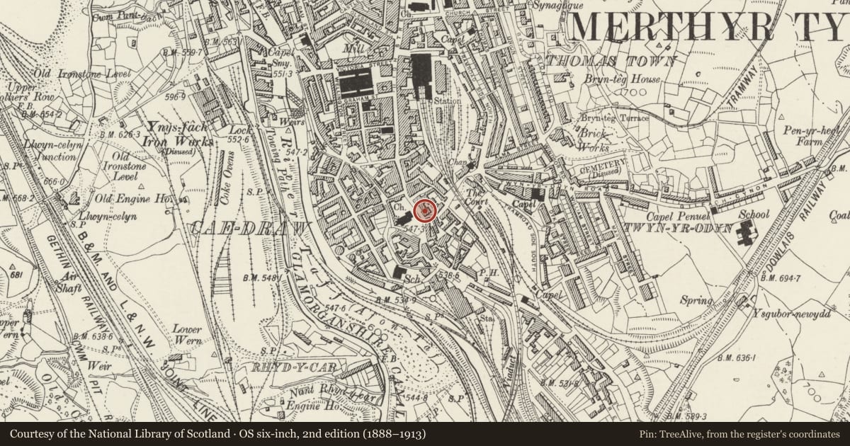
Slide toward Today to fade the historical sheet and see the modern map underneath.
David Rumsey Map Collection, Stanford LibrariesDavid Rumsey Map Collection, Stanford LibrariesDavid Rumsey Map Collection, Stanford LibrariesDavid Rumsey Map Collection, Stanford LibrariesDavid Rumsey Map Collection, Stanford Libraries
5 historical maps cover this location, the earliest the 1636 map "Cornubia : Devonia, Somersetus, Dorcestria, Wiltonia, Glocestria ..." (David Rumsey Map Collection, Stanford Libraries).
Historical maps covering this location
- 1636 · Cornubia : Devonia, Somersetus, Dorcestria, Wiltonia, Glocestria ... (David Rumsey Map Collection, Stanford Libraries)
- 1637 · The fourth table of England. Cornub. Devonia, Somerset etc. (David Rumsey Map Collection, Stanford Libraries)
- 1830 · V.3:11-15:XV. Britisches Reich. A. Kon: England. b. Frstenthum Wales: Shire: 37-40 (David Rumsey Map Collection, Stanford Libraries)
- 1895 · Sheet 11. Ordnance Survey of England and Wales. (David Rumsey Map Collection, Stanford Libraries)
- 1898 · 231 Merthyr Tydfil (Hills) (David Rumsey Map Collection, Stanford Libraries)
Cadw's description
Location
Set on modern concrete base in open ground immediately S of St Tydfil’s churchyard. Formerly located in centre of road further S, close to site of modern roundabout.
History
Later C19. Designed by W Macfarlane & Co, architectural ironfounders of Glasgow. Inscribed plate records the erection of the fountain "in commemoration of Robert and Lucy Thomas of Waunwyllt, the pioneers in 1828 of the South Wales Steam Coal Trade". Given by Sir W T Lewis and W T Rees of Aberdare, ca 1890.
Exterior
Octagonal, openwork iron canopy (in sections) with circular ribbed dome enriched by interlaced foliage trails, all surmounted by a heroic classical figure. Filigree spandrels to cusped arcades with rope-mouldings, circular armoria and guilloche bands. Griffin finials over volute brackets to angles, polygonal foliage capitals to leaf shafts with foliage frieze above square bases.
Nearby in the register
- Gates & Railings at St Tydfil's ChurchyardReligious, Ritual and Funeraryunder 1 mi
- St Tydfil's ChurchReligious, Ritual and Funeraryunder 1 mi
- Crown InnCommercialunder 1 mi
- The Court HouseDomesticunder 1 mi
Other entries of the same register within about three miles of this one, by straight line.