Cof Cymru: National Historic Assets of Wales · Wales
Merthyr Christian Centre
Town, Merthyr Tydfil, Wales
A Grade II listed building in Thomastown, Town, Merthyr Tydfil, designated on 16 October 1978.
The record
- Designation
- Listed building, Grade II
- Broad class
- Religious, Ritual and Funerary
- Date of designation
- 16 October 1978
- Locality
- Thomastown
- Community
- Town
- Unitary authority
- Merthyr Tydfil
- Country
- Wales
- Coordinates
- 51.74687, -3.37461
- Cadw reference
- 11426
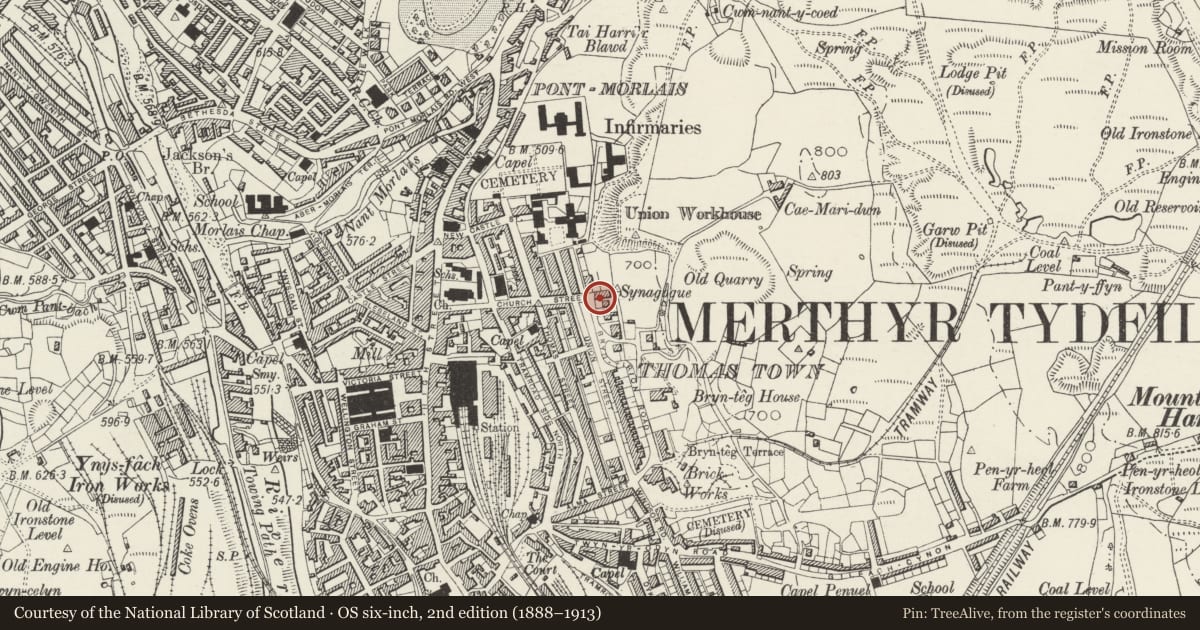
Slide toward Today to fade the historical sheet and see the modern map underneath.
David Rumsey Map Collection, Stanford LibrariesDavid Rumsey Map Collection, Stanford LibrariesDavid Rumsey Map Collection, Stanford LibrariesDavid Rumsey Map Collection, Stanford LibrariesDavid Rumsey Map Collection, Stanford Libraries
5 historical maps cover this location, the earliest the 1636 map "Cornubia : Devonia, Somersetus, Dorcestria, Wiltonia, Glocestria ..." (David Rumsey Map Collection, Stanford Libraries).
Historical maps covering this location
- 1636 · Cornubia : Devonia, Somersetus, Dorcestria, Wiltonia, Glocestria ... (David Rumsey Map Collection, Stanford Libraries)
- 1637 · The fourth table of England. Cornub. Devonia, Somerset etc. (David Rumsey Map Collection, Stanford Libraries)
- 1830 · V.3:11-15:XV. Britisches Reich. A. Kon: England. b. Frstenthum Wales: Shire: 37-40 (David Rumsey Map Collection, Stanford Libraries)
- 1895 · Sheet 11. Ordnance Survey of England and Wales. (David Rumsey Map Collection, Stanford Libraries)
- 1898 · 231 Merthyr Tydfil (Hills) (David Rumsey Map Collection, Stanford Libraries)
Cadw's description
Location
On an elevated site against the hillside with gabled front closing the view up Church Street.
History
Built as a Synagogue, 1872-5, in heavy Northern Gothic style.
Exterior
Snecked rubble facings with ashlar bands and dressings; slate roofs with red tiled ridges and finials. Crowning gable with polygonal finials and narrow louvred openings. 5-light window with lancets and blocked lights over 3-storey transverse n ex. Narrow entrance gable, with plate-traceried window under scissor-braced bargeboards, flanked by two 2-storey polygonal staircase turrets with conical roofs on eaves brackets, narrow windows with stone lintels. Double flight of steps with stone piers, iron balustrade (partly missing) and iron lamp standards rises to gabled doorway with dripstone.
Reason for designation
Included primarily for historic interest as the oldest remaining Synagogue building in Wales.
Nearby in the register
- Primrose HillDomesticunder 1 mi
- Bryn HeulogDomesticunder 1 mi
- Sunny BankDomesticunder 1 mi
- Former Unitarian ChapelReligious, Ritual and Funeraryunder 1 mi
Other entries of the same register within about three miles of this one, by straight line.