Cof Cymru: National Historic Assets of Wales · Wales
2 Chapel Row
Park, Merthyr Tydfil, Wales
A Grade II listed building in Georgetown, Park, Merthyr Tydfil, designated on 22 August 1975.
The record
- Designation
- Listed building, Grade II
- Broad class
- Domestic
- Date of designation
- 22 August 1975
- Locality
- Georgetown
- Community
- Park
- Unitary authority
- Merthyr Tydfil
- Country
- Wales
- Coordinates
- 51.75056, -3.38550
- Cadw reference
- 11410
Slide toward Today to fade the historical sheet and see the modern map underneath.
David Rumsey Map Collection, Stanford LibrariesDavid Rumsey Map Collection, Stanford LibrariesDavid Rumsey Map Collection, Stanford LibrariesDavid Rumsey Map Collection, Stanford LibrariesDavid Rumsey Map Collection, Stanford Libraries
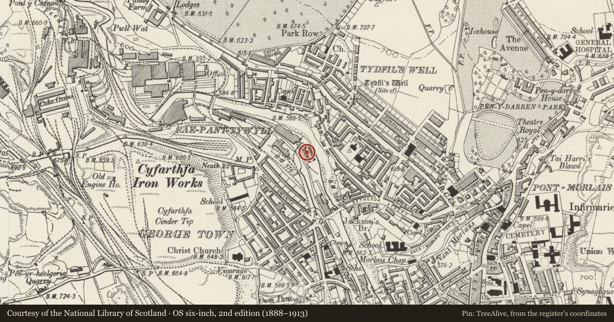
5 historical maps cover this location, the earliest the 1636 map "Cornubia : Devonia, Somersetus, Dorcestria, Wiltonia, Glocestria ..." (David Rumsey Map Collection, Stanford Libraries).
Historical maps covering this location
- 1636 · Cornubia : Devonia, Somersetus, Dorcestria, Wiltonia, Glocestria ... (David Rumsey Map Collection, Stanford Libraries)
- 1637 · The fourth table of England. Cornub. Devonia, Somerset etc. (David Rumsey Map Collection, Stanford Libraries)
- 1895 · Sheet 11. Ordnance Survey of England and Wales. (David Rumsey Map Collection, Stanford Libraries)
- 1898 · 231 Merthyr Tydfil (Hills) (David Rumsey Map Collection, Stanford Libraries)
- 1898 · 231 Merthyr Tydfil (Outline) (David Rumsey Map Collection, Stanford Libraries)
Cadw's description
Location
Situated in open ground to E of Omnibus Depot and backing on to River Taff.
History
Octagonal chapel opened 1805, converted to Storehouse by 1836 Survey Plan; row of houses added ca 1825.
Exterior
2-storey terraced row with taller remains of polygonal structure at N end. Uniform rubble frontage with some rough dressings; continuous slate roof, hipped to S end, brick stacks. 2-window fronts (wider at S end), cemented reveals under voussoir lintels (painted to No 1), modern small-pane sash windows. Central 6-panel doors (offset to No 5). Low walled forecourts with plain cappings link to splayed outer wall of former chapel/warehouse forward on left; pale quoins and round-arched window openings.
To W of Chapel Row is a reconstructed section of canal with ironwork frame of the (relocated) Rhydycar Iron Bridge.
Reason for designation
No 4 Chapel Row is celebrated as birthplace in 1841 of the famous composer Joseph Parry.
Nearby in the register
- 1 Chapel RowDomesticunder 1 mi
- 3 Chapel RowDomesticunder 1 mi
- Remains of chapel/Warehouse at the end of Chapel RowReligious, Ritual and Funeraryunder 1 mi
- 4 Chapel RowDomesticunder 1 mi
Other entries of the same register within about three miles of this one, by straight line.