Cof Cymru: National Historic Assets of Wales · Wales
Avery's
Llangollen, Denbighshire, Wales
A Grade II listed building in Llangollen, Denbighshire, designated on 22 December 1989.
The record
- Designation
- Listed building, Grade II
- Broad class
- Commercial
- Date of designation
- 22 December 1989
- Community
- Llangollen
- Unitary authority
- Denbighshire
- Country
- Wales
- Coordinates
- 52.96917, -3.17030
- Cadw reference
- 1139
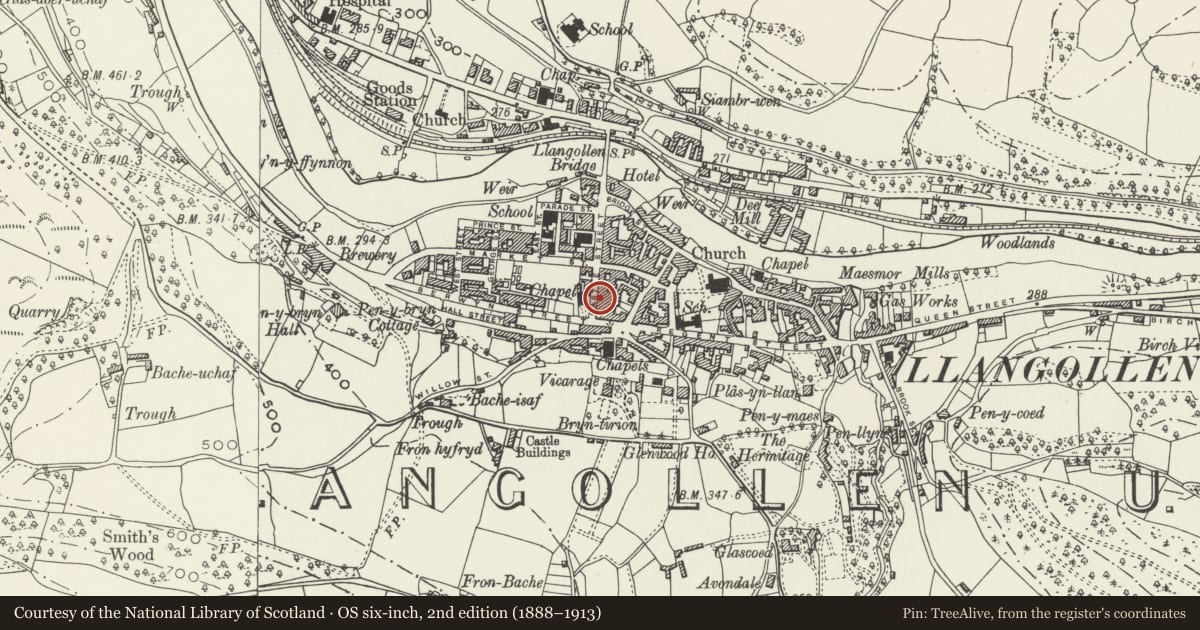
Slide toward Today to fade the historical sheet and see the modern map underneath.
David Rumsey Map Collection, Stanford LibrariesDavid Rumsey Map Collection, Stanford LibrariesDavid Rumsey Map Collection, Stanford LibrariesDavid Rumsey Map Collection, Stanford LibrariesLlyfrgell Genedlaethol Cymru – The National Library of Wales
5 historical maps cover this location, the earliest the 1795 map "To Sir Watkin Williams-Wynn Bart ... the map of the six counties of North Wales is most humbly inscribed by his obedient humble servant" (Llyfrgell Genedlaethol Cymru – The National Library of Wales).
Historical maps covering this location
- 1795 · To Sir Watkin Williams-Wynn Bart ... the map of the six counties of North Wales is most… (Llyfrgell Genedlaethol Cymru – The National Library of Wales)
- 1883 · Watershed map England, Wales 3. (David Rumsey Map Collection, Stanford Libraries)
- 1898 · 121 Wrexham (Hills) (David Rumsey Map Collection, Stanford Libraries)
- 1898 · 121 Wrexham (Outline) (David Rumsey Map Collection, Stanford Libraries)
- 1901 · Sheet 9 and 10. (David Rumsey Map Collection, Stanford Libraries)
Cadw's description
Location
Near the top end of the street.
History
Contemporary with the 1860's development of the town centre and the creation of Castle Street. This scheme was coneived by Morris Roberts (Owen Morris Roberts of Porthmadog) and the layout designed by W H Hill of Oswestry.
Exterior
3-storey, 3+2-window painted brick front; slate roof, stock brick chimney stacks and dentil eaves band; 2nd floor cill band. Mainly 4-pane sash windows; cornices to 1st floor. Fire certificate from Shropshire and North Wales Company. Contemporary shop front with splayed central entrance; decorative iron ventilation panels to stallriser. Modern shop window to right and 4-panel door at extreme right end.
Tall boarded doors to carriage entry at left opening onto brick cobbled path.
Lower extension to rear with panelled loading doors.
Reference: Hubbard, "Clwyd", p 219.
Reason for designation
Included for group value with neighbouring listed items on Castle Street (E side).
Nearby in the register
- Williams & MorganCommercialunder 1 mi
- Welsh Crafts & GiftsCommercialunder 1 mi
- Cegin CollenCommercialunder 1 mi
- Silver Palace TakeawayCommercialunder 1 mi
Other entries of the same register within about three miles of this one, by straight line.