Cof Cymru: National Historic Assets of Wales · Wales
Former Preswylfa Childrens Home
Bridgend, Bridgend, Wales
A Grade II listed building in Bridgend, designated on 26 February 1987.
The record
- Designation
- Listed building, Grade II
- Broad class
- Domestic
- Date of designation
- 26 February 1987
- Town
- Bridgend
- Community
- Bridgend
- Unitary authority
- Bridgend
- Country
- Wales
- Coordinates
- 51.49640, -3.58403
- Cadw reference
- 11343
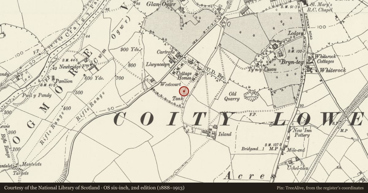
Slide toward Today to fade the historical sheet and see the modern map underneath.
David Rumsey Map Collection, Stanford LibrariesDavid Rumsey Map Collection, Stanford LibrariesDavid Rumsey Map Collection, Stanford LibrariesDavid Rumsey Map Collection, Stanford LibrariesDavid Rumsey Map Collection, Stanford Libraries
5 historical maps cover this location, the earliest the 1636 map "Cornubia : Devonia, Somersetus, Dorcestria, Wiltonia, Glocestria ..." (David Rumsey Map Collection, Stanford Libraries).
Historical maps covering this location
- 1636 · Cornubia : Devonia, Somersetus, Dorcestria, Wiltonia, Glocestria ... (David Rumsey Map Collection, Stanford Libraries)
- 1637 · The fourth table of England. Cornub. Devonia, Somerset etc. (David Rumsey Map Collection, Stanford Libraries)
- 1865 · England and Wales. England No. 6. (David Rumsey Map Collection, Stanford Libraries)
- 1897 · 262 Pontypridd (Hills) (David Rumsey Map Collection, Stanford Libraries)
- 1897 · 262 Pontypridd (Outline) (David Rumsey Map Collection, Stanford Libraries)
Cadw's description
Location
At the southern corner of a planned square.
History
Built 1902, part of the Bridgend and Cowbridge union.
Exterior
Twin-unit, symmetrically stepped, 2-storey, 6-window bull-nosed rubble front with low buttresses, plinth and freestone dressings. Tall tiled roofs, lower to ends, with overhanging eaves, ridge cresting and finials, rubble chimney stacks and central dividing parapet. Hipped and gabled cross roofs, advanced to penultimate bays, with lean-to porches to outer return walls. Mainly paired sash windows.
Half-hipped end walls, similar detail at rear with 2-single storey extensions.
In poor condition at the time of inspection (April 1986).
Reason for designation
Included for group value.
Nearby in the register
- Former Preswylfa Childrens HomeDomesticunder 1 mi
- Former Preswylfa Childrens HomeDomesticunder 1 mi
- Former Preswylfa Childrens HomeDomesticunder 1 mi
- Former Preswylfa Childrens HomeDomesticunder 1 mi
Other entries of the same register within about three miles of this one, by straight line.