Cof Cymru: National Historic Assets of Wales · Wales
Newcastle Castle
Bridgend, Bridgend, Wales
A Grade II* listed building in Newcastle, Bridgend, designated on 29 September 1986.
The record
- Designation
- Listed building, Grade II*
- Broad class
- Defence
- Date of designation
- 29 September 1986
- Locality
- Newcastle
- Community
- Bridgend
- Unitary authority
- Bridgend
- Country
- Wales
- Coordinates
- 51.50893, -3.58320
- Cadw reference
- 11313
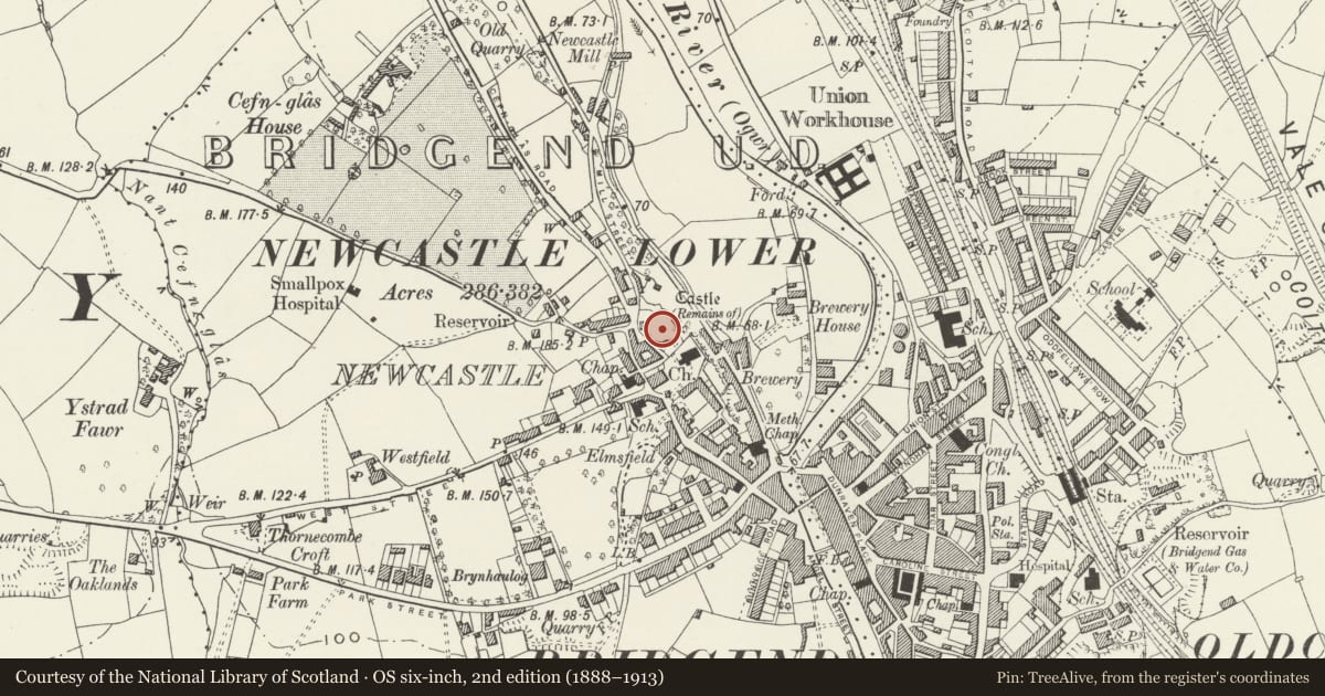
Slide toward Today to fade the historical sheet and see the modern map underneath.
David Rumsey Map Collection, Stanford LibrariesDavid Rumsey Map Collection, Stanford LibrariesDavid Rumsey Map Collection, Stanford LibrariesDavid Rumsey Map Collection, Stanford LibrariesDavid Rumsey Map Collection, Stanford Libraries
5 historical maps cover this location, the earliest the 1636 map "Cornubia : Devonia, Somersetus, Dorcestria, Wiltonia, Glocestria ..." (David Rumsey Map Collection, Stanford Libraries).
Historical maps covering this location
- 1636 · Cornubia : Devonia, Somersetus, Dorcestria, Wiltonia, Glocestria ... (David Rumsey Map Collection, Stanford Libraries)
- 1637 · The fourth table of England. Cornub. Devonia, Somerset etc. (David Rumsey Map Collection, Stanford Libraries)
- 1865 · England and Wales. England No. 6. (David Rumsey Map Collection, Stanford Libraries)
- 1897 · 262 Pontypridd (Hills) (David Rumsey Map Collection, Stanford Libraries)
- 1897 · 262 Pontypridd (Outline) (David Rumsey Map Collection, Stanford Libraries)
Cadw's description
Location
On an elevated site to N of St Illtyd's Parish Church.
History
Founded by 1106, rebuilt later C12 with late C16 additions. Passed through Turberville, Berkerolle and Gamage families, in 1718 bought by Samuel Edwin of Llanmihangel Place and later part of Dunraven estate.
Exterior
Polygonal plan; curtain wall with W and S towers and natural defence of cliff to E. Sutton stone; coursed rubble facing stones, some removed or lost particularly to E. S side retains substantial amounts of masonry; rectangular tower with 2-light windows with voussoir relieving arches; flanked by fine raised gateway c1175/80, the most complete of its kind in Glamorgan. Blind tympanum between semicircular and segmental arches, the latter billet moulded as are the jambs beside Romanesque shafts carrying roll moulding.
Remains of the keep to W and footings of the hall range to E.
Scheduled Ancient Monument GM063
Nearby in the register
- Newcastle CastleCastleunder 1 mi
- Church of St IlltydReligious, Ritual and Funeraryunder 1 mi
- West CottageDomesticunder 1 mi
- Nazareth Apostolic ChurchReligious, Ritual and Funeraryunder 1 mi
Other entries of the same register within about three miles of this one, by straight line.