Cof Cymru: National Historic Assets of Wales · Wales
NO.7 & parallel range to rear
Bridgend, Bridgend, Wales
A Grade II listed building in Bridgend, designated on 29 September 1986.
The record
- Designation
- Listed building, Grade II
- Broad class
- Domestic
- Date of designation
- 29 September 1986
- Community
- Bridgend
- Unitary authority
- Bridgend
- Country
- Wales
- Coordinates
- 51.50666, -3.57859
- Cadw reference
- 11289
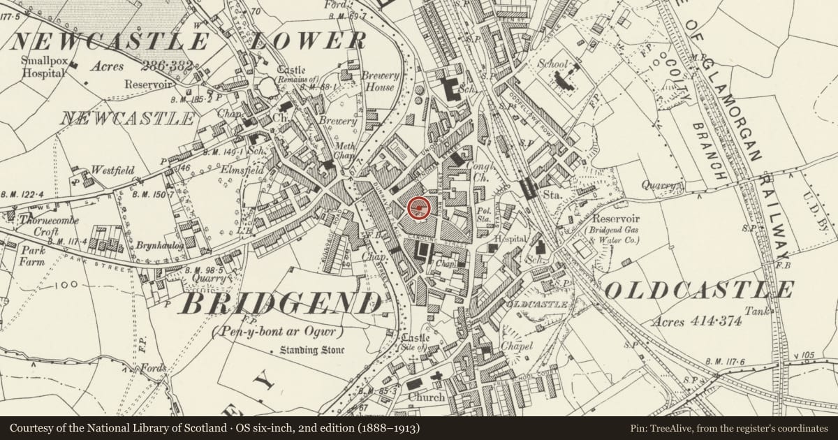
Slide toward Today to fade the historical sheet and see the modern map underneath.
David Rumsey Map Collection, Stanford LibrariesDavid Rumsey Map Collection, Stanford LibrariesDavid Rumsey Map Collection, Stanford LibrariesDavid Rumsey Map Collection, Stanford LibrariesDavid Rumsey Map Collection, Stanford Libraries
5 historical maps cover this location, the earliest the 1636 map "Cornubia : Devonia, Somersetus, Dorcestria, Wiltonia, Glocestria ..." (David Rumsey Map Collection, Stanford Libraries).
Historical maps covering this location
- 1636 · Cornubia : Devonia, Somersetus, Dorcestria, Wiltonia, Glocestria ... (David Rumsey Map Collection, Stanford Libraries)
- 1637 · The fourth table of England. Cornub. Devonia, Somerset etc. (David Rumsey Map Collection, Stanford Libraries)
- 1865 · England and Wales. England No. 6. (David Rumsey Map Collection, Stanford Libraries)
- 1897 · 262 Pontypridd (Hills) (David Rumsey Map Collection, Stanford Libraries)
- 1897 · 262 Pontypridd (Outline) (David Rumsey Map Collection, Stanford Libraries)
Cadw's description
Location
Forward to the street at the rear of the Wyndham Hotel; adjacent to former stable courtyard of Wyndham Hotel.
Exterior
Early C19 varied short 2-storey terrace; scribed stucco except No 1 which is roughcast, frontages with plinths, slate roofs and brick capped rubble chimney stacks. 3+1 windows to No 1 (formerly the Red Lion PH), 1 window to Nos 3 to 11. Recessed sash glazing, mostly 12-pane retained; architraves to No 1, some voussoir lintels. Canted angle to left end of No 1 with 12 pane sash over boarded door entrance. Various front doors with small pane fanlights to Nos 5, 7 and 9.
Whitewashed rubble right end wall. Rubble rear with brick segmental headed lintels to casement windows; slate roof lean-tos and one with cross range.
No 1 in poor condition at time of inspection (April 1986); ground floor of No 3 considerably altered in making of Chinese restaurant; No 5 boarded up.
Reason for designation
Group value.
Nearby in the register
- NO.5 & parallel range to rearDomesticunder 1 mi
- NO.9 & parallel range to rearDomesticunder 1 mi
- NO.3 & parallel range to rearCommercialunder 1 mi
- NO.11 & parallel range to rearReligious, Ritual and Funeraryunder 1 mi
Other entries of the same register within about three miles of this one, by straight line.