Cof Cymru: National Historic Assets of Wales · Wales
Y Bwthyn
Pontardulais, Swansea, Wales
A Grade II listed building in Pontarddulais, Pontardulais, Swansea, designated on 4 April 1975.
The record
- Designation
- Listed building, Grade II
- Broad class
- Domestic
- Date of designation
- 4 April 1975
- Locality
- Pontarddulais
- Community
- Pontardulais
- Unitary authority
- Swansea
- Country
- Wales
- Coordinates
- 51.71549, -4.03479
- Cadw reference
- 11194
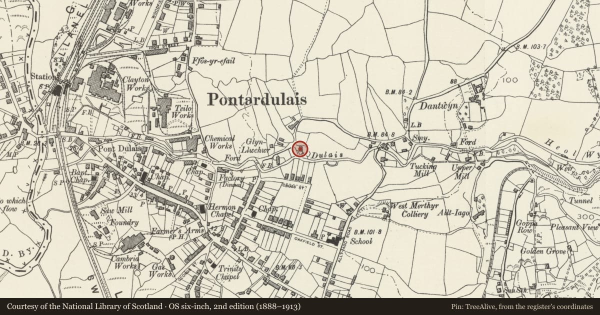
Slide toward Today to fade the historical sheet and see the modern map underneath.
David Rumsey Map Collection, Stanford LibrariesDavid Rumsey Map Collection, Stanford LibrariesDavid Rumsey Map Collection, Stanford LibrariesDavid Rumsey Map Collection, Stanford LibrariesDavid Rumsey Map Collection, Stanford Libraries
5 historical maps cover this location, the earliest the 1636 map "Cornubia : Devonia, Somersetus, Dorcestria, Wiltonia, Glocestria ..." (David Rumsey Map Collection, Stanford Libraries).
Historical maps covering this location
- 1636 · Cornubia : Devonia, Somersetus, Dorcestria, Wiltonia, Glocestria ... (David Rumsey Map Collection, Stanford Libraries)
- 1891 · Sheet 10. Ordnance Survey of England and Wales. . (David Rumsey Map Collection, Stanford Libraries)
- 1898 · 230 Ammanford (Hills) (David Rumsey Map Collection, Stanford Libraries)
- 1898 · 230 Ammanford (Outline) (David Rumsey Map Collection, Stanford Libraries)
- 1920 · Sheet 100. Llanelly. (David Rumsey Map Collection, Stanford Libraries)
Cadw's description
Location
Set back from the road at the SE of a bend, between neighbouring buildings.
History
Two-unit, direct-entry cottage with hall and outer room. c1800, extended later. Subsidiary small dwelling to right end.
Exterior
Single storey and attic C18-type of cottage, on a roughly E-W axis, formerly two cottages. Rubble stone, covered in roughcast render, with traditional Welsh thatched roof. Taller range to N, with higher eaves and ridges and large roughcast stack to S end. West frontage has modern gabled porch to centre, heightened in 2002, with small 8-pane horned timber sashes with stone sills and plain reveals to each side. S gable end has small attic light with timber lintel. Lower range to S is slightly recessed with single horned sash to W frontage, with stone sill. Stack to S end in painted roughcast. Modern ground floor projections to E behind both ranges, and small modern extensions to N and S ends. S extension is almost full-height with Welsh slate gabled roof and painted timber barge-board.
Interior
Not inspected.
Reason for designation
Included as a rare survival of a traditional cottage type for the area, and for its thatched roof - the last in the parish.
Nearby in the register
- Hope Independent ChapelReligious, Ritual and Funeraryunder 1 mi
- Wall and Railings at Hope Independent ChapelNo class recordedunder 1 mi
- The War MemorialCommemorativeunder 1 mi
- Neuadd-fachDomesticunder 1 mi
Other entries of the same register within about three miles of this one, by straight line.