Cof Cymru: National Historic Assets of Wales · Wales
Barn to the rear of Llandyfan
Cyngor Bro Dyffryn Cennen, Carmarthenshire, Wales
A Grade II listed building in Llandyfan, Ammanford, Cyngor Bro Dyffryn Cennen, Carmarthenshire, designated on 7 June 1989.
The record
- Designation
- Listed building, Grade II
- Broad class
- Agriculture and Subsistence
- Date of designation
- 7 June 1989
- Locality
- Llandyfan
- Town
- Ammanford
- Community
- Cyngor Bro Dyffryn Cennen
- Unitary authority
- Carmarthenshire
- Country
- Wales
- Coordinates
- 51.83617, -3.97223
- Cadw reference
- 11143
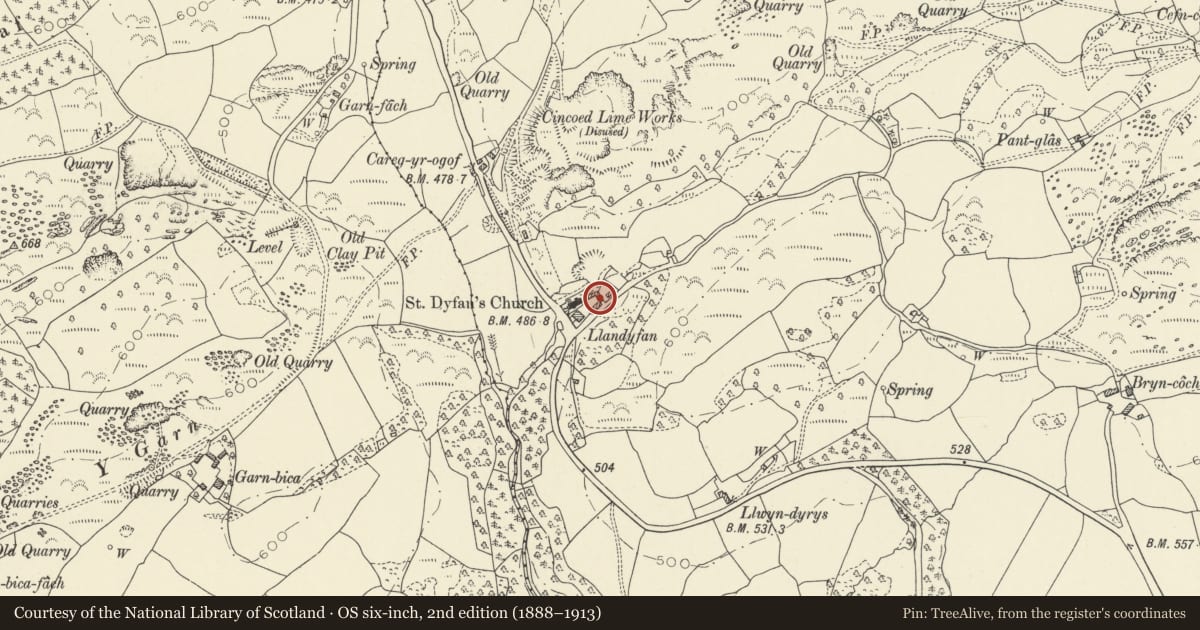
Slide toward Today to fade the historical sheet and see the modern map underneath.
David Rumsey Map Collection, Stanford LibrariesDavid Rumsey Map Collection, Stanford LibrariesDavid Rumsey Map Collection, Stanford LibrariesDavid Rumsey Map Collection, Stanford LibrariesDavid Rumsey Map Collection, Stanford Libraries
5 historical maps cover this location, the earliest the 1860 map "41. Caermathen." (David Rumsey Map Collection, Stanford Libraries).
Historical maps covering this location
- 1860 · 41. Caermathen. (David Rumsey Map Collection, Stanford Libraries)
- 1891 · Sheet 10. Ordnance Survey of England and Wales. . (David Rumsey Map Collection, Stanford Libraries)
- 1898 · 230 Ammanford (Hills) (David Rumsey Map Collection, Stanford Libraries)
- 1898 · 230 Ammanford (Outline) (David Rumsey Map Collection, Stanford Libraries)
- 1901 · Sheet 14. (David Rumsey Map Collection, Stanford Libraries)
Cadw's description
Location
Situated across upper end of farmyard to rear of Llandyfan.
History
Substantial barn in farmyard at Llandyfan, with date 1802 prominently painted on roof trusses.
Exterior
Barn, rubble stone with dressed quoins and hipped slate roof. Two tall cart openings with stone voussoirs to cambered heads and originally with tall boarded double doors, part surviving in right door. Long slit vents to centre and each side, that to right obscured by the addition of the S range. Rear wall is near identical to front.
Interior
Twin stone flagged threshing floors. Five-bay roof of oak pegged tie-beam and collar trusses, one with painted date 1802. Stepped double purlins.
Reason for designation
Included as a good example of a late Georgian high-door barn of the gentry type with its formal symmetry, hipped roof and placing at the head of the yard.
Nearby in the register
- Outbuilding on N side of farmyard at LlandyfanAgriculture and Subsistenceunder 1 mi
- Outbuildings on SE side of farmyard at LlandyfanAgriculture and Subsistenceunder 1 mi
- Lime Kiln to rear of LlandyfanIndustrialunder 1 mi
- Church of St DyfanReligious, Ritual and Funeraryunder 1 mi
Other entries of the same register within about three miles of this one, by straight line.