Cof Cymru: National Historic Assets of Wales · Wales
The Mill House, Llandybie
Llandybie, Carmarthenshire, Wales
A Grade II listed building in Llandybie village, Ammanford, Llandybie, Carmarthenshire, designated on 12 October 1972.
The record
- Designation
- Listed building, Grade II
- Broad class
- Industrial
- Date of designation
- 12 October 1972
- Locality
- Llandybie village
- Town
- Ammanford
- Community
- Llandybie
- Unitary authority
- Carmarthenshire
- Country
- Wales
- Coordinates
- 51.82113, -4.00429
- Cadw reference
- 11120
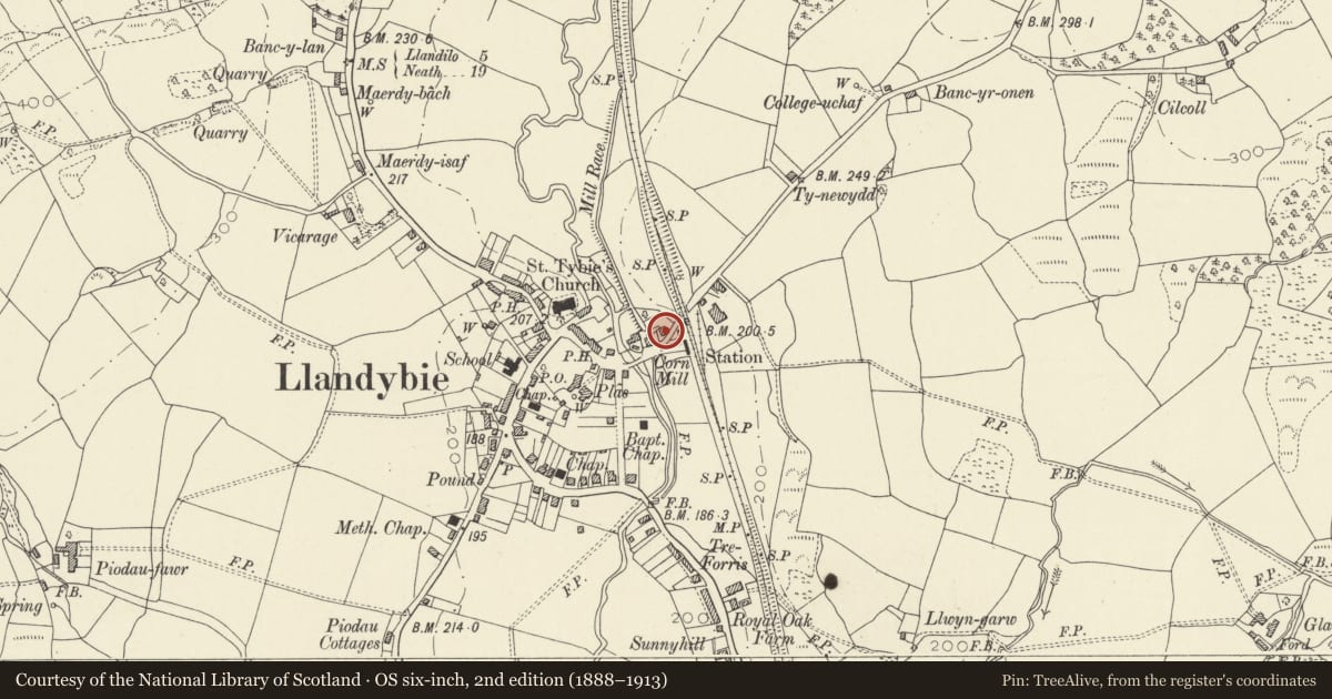
Slide toward Today to fade the historical sheet and see the modern map underneath.
David Rumsey Map Collection, Stanford LibrariesDavid Rumsey Map Collection, Stanford LibrariesDavid Rumsey Map Collection, Stanford LibrariesDavid Rumsey Map Collection, Stanford LibrariesDavid Rumsey Map Collection, Stanford Libraries
5 historical maps cover this location, the earliest the 1860 map "41. Caermathen." (David Rumsey Map Collection, Stanford Libraries).
Historical maps covering this location
- 1860 · 41. Caermathen. (David Rumsey Map Collection, Stanford Libraries)
- 1891 · Sheet 10. Ordnance Survey of England and Wales. . (David Rumsey Map Collection, Stanford Libraries)
- 1898 · 230 Ammanford (Hills) (David Rumsey Map Collection, Stanford Libraries)
- 1898 · 230 Ammanford (Outline) (David Rumsey Map Collection, Stanford Libraries)
- 1901 · Sheet 14. (David Rumsey Map Collection, Stanford Libraries)
Cadw's description
Location
To the east of Llandybie mill. Stone rubble enclosing wall (modern concrete blockwork to street side) with steps down to the mill yard.
History
Small house with an early C19 front, though the large chimneys suggest an earlier date; perhaps C18. In 1840 it was recorded as mill, homestead and waste in the occupation of Evan Evans.
Exterior
A two-storey, three-window miller's house facing west towards Llandybie mill. Whitewashed stone at front and side, the front in axe-dressed masonry, the side in rubble; rough-cast at rear. Slate roof with tile ridge, timber bargeboards; large rendered end-chimneys. Gabled roof carried down to a catslide over the rear extension. Sash windows of twelve panes, exposed frames, horned sashes; panelled door with overlight and slightly cambered head. Modern door and windows at rear.
Reason for designation
A fine miller's house retaining good C19 character and forming a group with the mill.
Nearby in the register
- The Mill, LlandybieIndustrialunder 1 mi
- Llandybie BridgeTransportunder 1 mi
- Stone Spheres at Entrance to Plâs LlandybieDomesticunder 1 mi
- Church of St. TybieReligious, Ritual and Funeraryunder 1 mi
Other entries of the same register within about three miles of this one, by straight line.