Cof Cymru: National Historic Assets of Wales · Wales
23 Bridge Street
Llangollen, Denbighshire, Wales
A Grade II listed building in Llangollen, Denbighshire, designated on 22 December 1989.
The record
- Designation
- Listed building, Grade II
- Broad class
- Commercial
- Date of designation
- 22 December 1989
- Community
- Llangollen
- Unitary authority
- Denbighshire
- Country
- Wales
- Coordinates
- 52.97001, -3.16878
- Cadw reference
- 1112
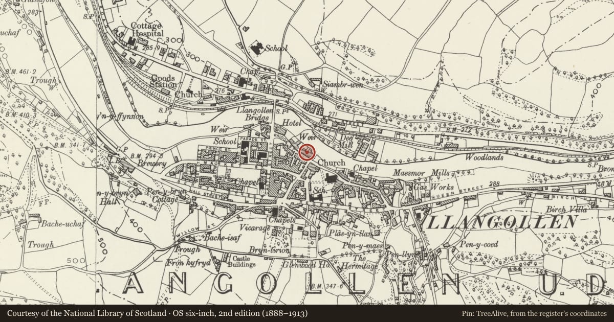
Slide toward Today to fade the historical sheet and see the modern map underneath.
David Rumsey Map Collection, Stanford LibrariesDavid Rumsey Map Collection, Stanford LibrariesDavid Rumsey Map Collection, Stanford LibrariesDavid Rumsey Map Collection, Stanford LibrariesLlyfrgell Genedlaethol Cymru – The National Library of Wales
5 historical maps cover this location, the earliest the 1795 map "To Sir Watkin Williams-Wynn Bart ... the map of the six counties of North Wales is most humbly inscribed by his obedient humble servant" (Llyfrgell Genedlaethol Cymru – The National Library of Wales).
Historical maps covering this location
- 1795 · To Sir Watkin Williams-Wynn Bart ... the map of the six counties of North Wales is most… (Llyfrgell Genedlaethol Cymru – The National Library of Wales)
- 1883 · Watershed map England, Wales 3. (David Rumsey Map Collection, Stanford Libraries)
- 1898 · 121 Wrexham (Hills) (David Rumsey Map Collection, Stanford Libraries)
- 1898 · 121 Wrexham (Outline) (David Rumsey Map Collection, Stanford Libraries)
- 1901 · Sheet 9 and 10. (David Rumsey Map Collection, Stanford Libraries)
Cadw's description
Location
Detached to left; set into line of street frontages.
Exterior
Early C18 pair of 3-storey, 2-window painted black fronts, part rubble to ground floor. Slate roofs, boarded eaves and cement render end chimney stacks. Deep cill bands, rubble quoins and plinth. Small pane casement windows, lintels and fluted keystones to 1st floor. Modern shop front to No 21 and early C19 regency front to No 23; fascia bowed out over two 4-pane shop windows, central half glazed door and overlight. 4-panel door between the two shops, numbered 23.
Rubble left end with cross range; one stone dated 1883. Further rubble chimney stack and 1 small window; very tall cellar. Small sash windows at rear with brace plates and a broken loading platform and hoist; indicates a former commercial use.
Interior
The interior of No 21 retains dog-leg staircase with fluted newel, moulded handrail and turned balusters; the upper flight appears slightly earlier. Some half-timber partition walls and a roll moulded cross beam to rear parlour. 6-panel doors and a good C19 iron firegrate to 1st floor.
Reason for designation
Group value.
Nearby in the register
- 21 Bridge StreetCommercialunder 1 mi
- Seventh HeavenDomesticunder 1 mi
- 19 Bridge StreetCommercialunder 1 mi
- HenblasCommercialunder 1 mi
Other entries of the same register within about three miles of this one, by straight line.