Cof Cymru: National Historic Assets of Wales · Wales
4 Railway Terrace
Llandeilo, Carmarthenshire, Wales
A Grade II listed building in Llandeilo, Carmarthenshire, designated on 24 June 1991.
The record
- Designation
- Listed building, Grade II
- Broad class
- Commercial
- Date of designation
- 24 June 1991
- Community
- Llandeilo
- Unitary authority
- Carmarthenshire
- Country
- Wales
- Coordinates
- 51.88491, -3.99095
- Cadw reference
- 11075
Slide toward Today to fade the historical sheet and see the modern map underneath.
David Rumsey Map Collection, Stanford LibrariesDavid Rumsey Map Collection, Stanford LibrariesDavid Rumsey Map Collection, Stanford LibrariesDavid Rumsey Map Collection, Stanford LibrariesDavid Rumsey Map Collection, Stanford Libraries
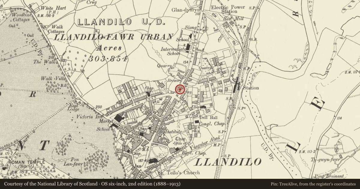
5 historical maps cover this location, the earliest the 1860 map "41. Caermathen." (David Rumsey Map Collection, Stanford Libraries).
Historical maps covering this location
- 1860 · 41. Caermathen. (David Rumsey Map Collection, Stanford Libraries)
- 1891 · Sheet 10. Ordnance Survey of England and Wales. . (David Rumsey Map Collection, Stanford Libraries)
- 1898 · 212 Llandovery (Outline) (David Rumsey Map Collection, Stanford Libraries)
- 1898 · 212 Llandovery (Hills) (David Rumsey Map Collection, Stanford Libraries)
- 1901 · Sheet 14. (David Rumsey Map Collection, Stanford Libraries)
Cadw's description
Location
On the street line just down from the junction with Crescent Road.
Exterior
Ca l9l0. 2 storey, 2 window art nouveau style shop. Colourwashed roughcast on rubble. Moderately pitched slate roof, oversailing eaves, exposed rafters. Rendered stacks, lozenge motif to centre stack..
Mock timbered gables on brackets over lst floor canted oriels. Deep verges, bargeboards with finials. Rectangular toplights with lead cames to oriels. 2 light small paned casement windows, similar narrow sidelights. Continuous moulded cornice with paired brackets and dentils corniced forward under oriels on large consoles. Gabled fascia ends. End pilasters with lozenge motif over fluting with leaf finials. Shop window to right. Recessed doorway on left, small paned glazed door. Small paned, stained glass toplights, moulded tops. Plate glass windows. Cross window to left, lead cames to upper lights. House doorway to extreme left, half glazed door, moulded vertical panels. Pilasters as shopfront.
Nearby in the register
- 3 Railway TerraceCommercialunder 1 mi
- Prospect HouseCommercialunder 1 mi
- Salem Welsh Calvinistic Methodist ChapelReligious, Ritual and Funeraryunder 1 mi
- National Westminster BankCommercialunder 1 mi
Other entries of the same register within about three miles of this one, by straight line.