Cof Cymru: National Historic Assets of Wales · Wales
Midland Bank
Llangollen, Denbighshire, Wales
A Grade II listed building in Llangollen, Denbighshire, designated on 22 December 1989.
The record
- Designation
- Listed building, Grade II
- Broad class
- Commercial
- Date of designation
- 22 December 1989
- Community
- Llangollen
- Unitary authority
- Denbighshire
- Country
- Wales
- Coordinates
- 52.97033, -3.16944
- Cadw reference
- 1106
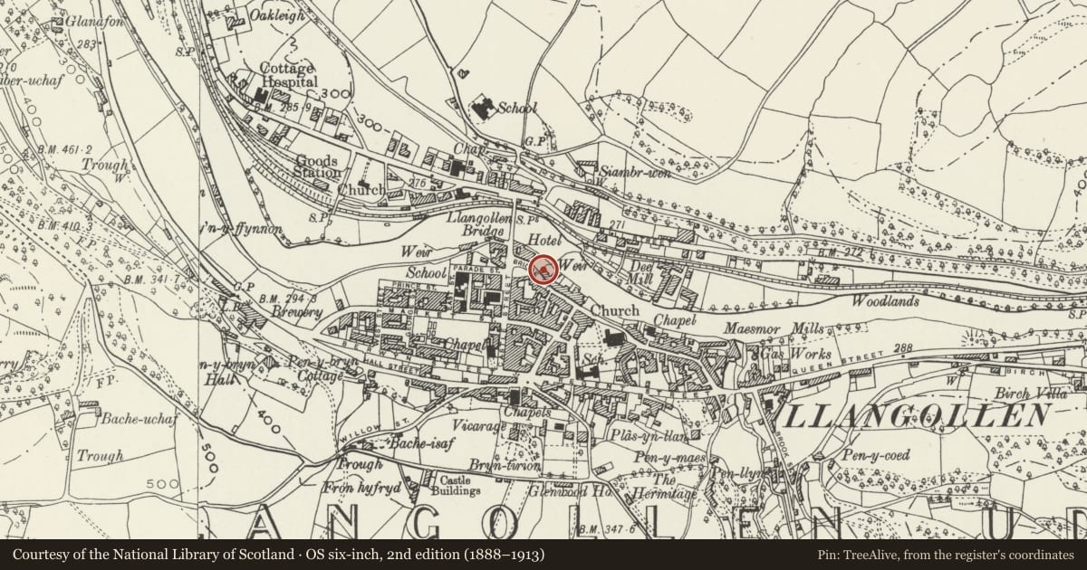
Slide toward Today to fade the historical sheet and see the modern map underneath.
David Rumsey Map Collection, Stanford LibrariesDavid Rumsey Map Collection, Stanford LibrariesDavid Rumsey Map Collection, Stanford LibrariesDavid Rumsey Map Collection, Stanford LibrariesLlyfrgell Genedlaethol Cymru – The National Library of Wales
5 historical maps cover this location, the earliest the 1795 map "To Sir Watkin Williams-Wynn Bart ... the map of the six counties of North Wales is most humbly inscribed by his obedient humble servant" (Llyfrgell Genedlaethol Cymru – The National Library of Wales).
Historical maps covering this location
- 1795 · To Sir Watkin Williams-Wynn Bart ... the map of the six counties of North Wales is most… (Llyfrgell Genedlaethol Cymru – The National Library of Wales)
- 1883 · Watershed map England, Wales 3. (David Rumsey Map Collection, Stanford Libraries)
- 1898 · 121 Wrexham (Hills) (David Rumsey Map Collection, Stanford Libraries)
- 1898 · 121 Wrexham (Outline) (David Rumsey Map Collection, Stanford Libraries)
- 1901 · Sheet 9 and 10. (David Rumsey Map Collection, Stanford Libraries)
Cadw's description
Location
Detached near the end of the street.
History
The branch was opened in 1863 in part of an earlier building; the remainder purchased in 1867. Given banking front treatment in 1881 - 83 by Morris Roberts and Co and Woolfall and Eccles made internal alterations in 1923-24.
Exterior
3-storey, 4-window pebbledash front with rusticated quoins and ground floor; cill bands and plinths. Slate roof and casement render chimney stacks. Horned 4-pane sash windows with lugged architraves, keystones and bracket cills. Shouldered bank windows to ground floor with figurehead carvings to large keystones; one window blocked; entrance to left.
Reason for designation
Included for group value.
Nearby in the register
- 10 Bridge StreetDomesticunder 1 mi
- The Woolpack RestaurantCommercialunder 1 mi
- 12 Bridge StreetDomesticunder 1 mi
- 14 Bridge StreetCommercialunder 1 mi
Other entries of the same register within about three miles of this one, by straight line.