Cof Cymru: National Historic Assets of Wales · Wales
Cambrian Hotel
Llangollen, Denbighshire, Wales
A Grade II listed building in Llangollen, Denbighshire, designated on 22 December 1989.
The record
- Designation
- Listed building, Grade II
- Broad class
- Commercial
- Date of designation
- 22 December 1989
- Community
- Llangollen
- Unitary authority
- Denbighshire
- Country
- Wales
- Coordinates
- 52.96921, -3.17269
- Cadw reference
- 1104
Slide toward Today to fade the historical sheet and see the modern map underneath.
David Rumsey Map Collection, Stanford LibrariesDavid Rumsey Map Collection, Stanford LibrariesDavid Rumsey Map Collection, Stanford LibrariesDavid Rumsey Map Collection, Stanford LibrariesLlyfrgell Genedlaethol Cymru – The National Library of Wales
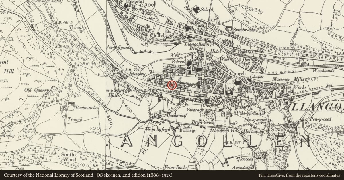
5 historical maps cover this location, the earliest the 1795 map "To Sir Watkin Williams-Wynn Bart ... the map of the six counties of North Wales is most humbly inscribed by his obedient humble servant" (Llyfrgell Genedlaethol Cymru – The National Library of Wales).
Historical maps covering this location
- 1795 · To Sir Watkin Williams-Wynn Bart ... the map of the six counties of North Wales is most… (Llyfrgell Genedlaethol Cymru – The National Library of Wales)
- 1883 · Watershed map England, Wales 3. (David Rumsey Map Collection, Stanford Libraries)
- 1898 · 121 Wrexham (Hills) (David Rumsey Map Collection, Stanford Libraries)
- 1898 · 121 Wrexham (Outline) (David Rumsey Map Collection, Stanford Libraries)
- 1901 · Sheet 9 and 10. (David Rumsey Map Collection, Stanford Libraries)
Cadw's description
Location
At the roadside on western edge of the town.
Exterior
Mid C19 late Georgian 3-storey 1+3-window pebbledash front with cill bands, plinth and rusticated quoins. Slate roof and cement render chimney stacks. Cement architraves to small pane sash windows to 2nd and ground floors. 1st floor has splayed bays with small pane casement glazing and panelled aprons. French windows to 3rd bay opening onto iron railed balcony - similar balcony between left hand bays. The bays are thus linked and form a hood over the ground floor. 4-panel main door with deeply lugged architrave. Cill bands continue around left and right gable ends with name boards.
Interior
Small pane sash windows to rear with cambered heads to 1st and ground floors; cill bands. Cellar opening and doorways to left and right.
Reason for designation
Group value with the Post Office.
Nearby in the register
- Post Office (excluding Dalesford)Communicationsunder 1 mi
- TregwernDomesticunder 1 mi
- Masonic HallInstitutionalunder 1 mi
- Laurel CottageDomesticunder 1 mi
Other entries of the same register within about three miles of this one, by straight line.