Cof Cymru: National Historic Assets of Wales · Wales
Bank House
Llandeilo, Carmarthenshire, Wales
A Grade II listed building in Llandeilo, Carmarthenshire, designated on 24 June 1991.
The record
- Designation
- Listed building, Grade II
- Broad class
- Domestic
- Date of designation
- 24 June 1991
- Locality
- Llandeilo
- Community
- Llandeilo
- Unitary authority
- Carmarthenshire
- Country
- Wales
- Coordinates
- 51.88186, -3.99442
- Cadw reference
- 11034
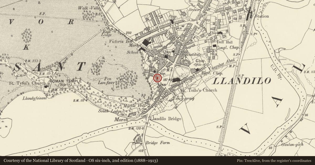
Slide toward Today to fade the historical sheet and see the modern map underneath.
David Rumsey Map Collection, Stanford LibrariesDavid Rumsey Map Collection, Stanford LibrariesDavid Rumsey Map Collection, Stanford LibrariesDavid Rumsey Map Collection, Stanford LibrariesDavid Rumsey Map Collection, Stanford Libraries
5 historical maps cover this location, the earliest the 1860 map "41. Caermathen." (David Rumsey Map Collection, Stanford Libraries).
Historical maps covering this location
- 1860 · 41. Caermathen. (David Rumsey Map Collection, Stanford Libraries)
- 1891 · Sheet 10. Ordnance Survey of England and Wales. . (David Rumsey Map Collection, Stanford Libraries)
- 1898 · 212 Llandovery (Outline) (David Rumsey Map Collection, Stanford Libraries)
- 1898 · 212 Llandovery (Hills) (David Rumsey Map Collection, Stanford Libraries)
- 1901 · Sheet 14. (David Rumsey Map Collection, Stanford Libraries)
Cadw's description
Location
Situated in a terrace above W side of churchyard and overlooking St Teilo's Church.
History
Tall 3-storey and basement late Georgian (cl790) townhouse built together with No 3 to left. Originally housed the Bank of the Black Ox, later the London and Provincial Bank Ltd.
Exterior
Band courses to 3-window, painted render facade. Pitched slate roof, tall rendered and banded stacks, oversailing eaves. 4-pane sashes. Iron-bar grille to ground floor right. Panelled door under semi-circular fanlight. Steps flanked by scrolled ironwork railings. Cross-gabled wing to rear.
Interior
Interior 'returns' late Georgian detailing on all floors including panelled window splays, panelled doors, chimney pieces etc. Front hall with arched screens including turned fanlights. Plain dogleg staircase, reeded architraves to first-floor doorcases.
Reason for designation
Group value; prominent location seen from town centre.
Nearby in the register
- The Old BankDomesticunder 1 mi
- 3 Bank TerraceDomesticunder 1 mi
- 1 George HillDomesticunder 1 mi
- 4 Bank TerraceDomesticunder 1 mi
Other entries of the same register within about three miles of this one, by straight line.