Cof Cymru: National Historic Assets of Wales · Wales
14 Bank Buildings
Llandeilo, Carmarthenshire, Wales
A Grade II listed building in Llandeilo, Carmarthenshire, designated on 24 June 1991.
The record
- Designation
- Listed building, Grade II
- Broad class
- Domestic
- Date of designation
- 24 June 1991
- Community
- Llandeilo
- Unitary authority
- Carmarthenshire
- Country
- Wales
- Coordinates
- 51.88414, -3.99297
- Cadw reference
- 11033
Slide toward Today to fade the historical sheet and see the modern map underneath.
David Rumsey Map Collection, Stanford LibrariesDavid Rumsey Map Collection, Stanford LibrariesDavid Rumsey Map Collection, Stanford LibrariesDavid Rumsey Map Collection, Stanford LibrariesDavid Rumsey Map Collection, Stanford Libraries
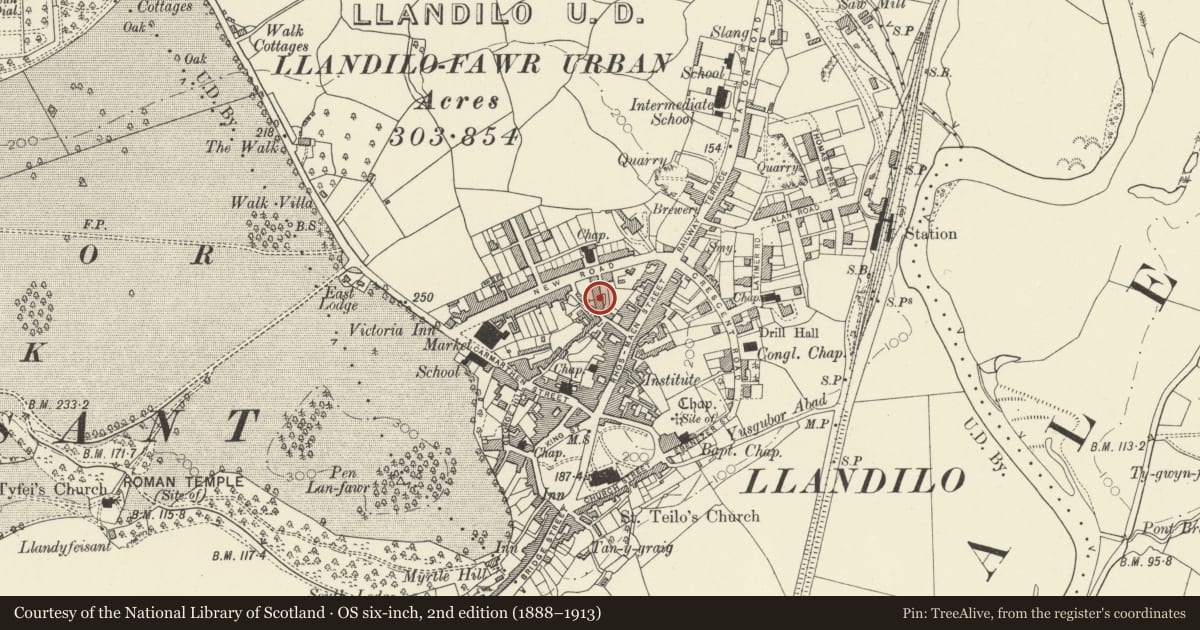
5 historical maps cover this location, the earliest the 1860 map "41. Caermathen." (David Rumsey Map Collection, Stanford Libraries).
Historical maps covering this location
- 1860 · 41. Caermathen. (David Rumsey Map Collection, Stanford Libraries)
- 1891 · Sheet 10. Ordnance Survey of England and Wales. . (David Rumsey Map Collection, Stanford Libraries)
- 1898 · 212 Llandovery (Outline) (David Rumsey Map Collection, Stanford Libraries)
- 1898 · 212 Llandovery (Hills) (David Rumsey Map Collection, Stanford Libraries)
- 1901 · Sheet 14. (David Rumsey Map Collection, Stanford Libraries)
Cadw's description
Location
Prominently sited just in from the junction with New Road.
Exterior
Late Cl8 house subdivided in later Cl9. 3 storey and basement, 5 window, double pile house. Colourwashed stucco on rubble. Gently pitched slate roof, close verges. Rendered projecting end stacks. Dentil eaves cornice.
6 pane sash windows to 2nd floor. l2 pane sash windows to lst and ground floors. Central doorway. Tuscan timber portico, open pediment with dentils on columns with pilasters flanking doorway.
Blind radial fanlight over recessed broad 6 fielded panel door, upper 2 glazed.
Shallow area forecourt with basement windows. Original wrought iron railings, spear pointed with Urn finials to stanchions.
2 storey, l window service wing adjoins to left. Colourwashed stucco on rubble. Gently pitched slate roof, close verges. Rendered stack. Dentil eaves cornice. l2 pane sash window to lst floor similar window to ground floor below. Doorway to right. Cl9 Gabled hood on brackets, sunk panelled pilasters. Original 6 panel door, upper 2 glazed. Rubble revetment wall to front.
Rear elevation. Two 6 pane sash windows to 2nd floor. Three l2 pane sashes to lst floor. Similar to ground floor flanking later lean-to projection.
Nearby in the register
- Bank BuildingsDomesticunder 1 mi
- National Westminster BankCommercialunder 1 mi
- Salem Welsh Calvinistic Methodist ChapelReligious, Ritual and Funeraryunder 1 mi
- Dewi Price & Co SolicitorsCommercialunder 1 mi
Other entries of the same register within about three miles of this one, by straight line.