Cof Cymru: National Historic Assets of Wales · Wales
26 Stone Street
Llandovery, Carmarthenshire, Wales
A Grade II listed building in Llandovery, Carmarthenshire, designated on 26 February 1981.
The record
- Designation
- Listed building, Grade II
- Broad class
- Domestic
- Date of designation
- 26 February 1981
- Community
- Llandovery
- Unitary authority
- Carmarthenshire
- Country
- Wales
- Coordinates
- 51.99536, -3.79671
- Cadw reference
- 11024
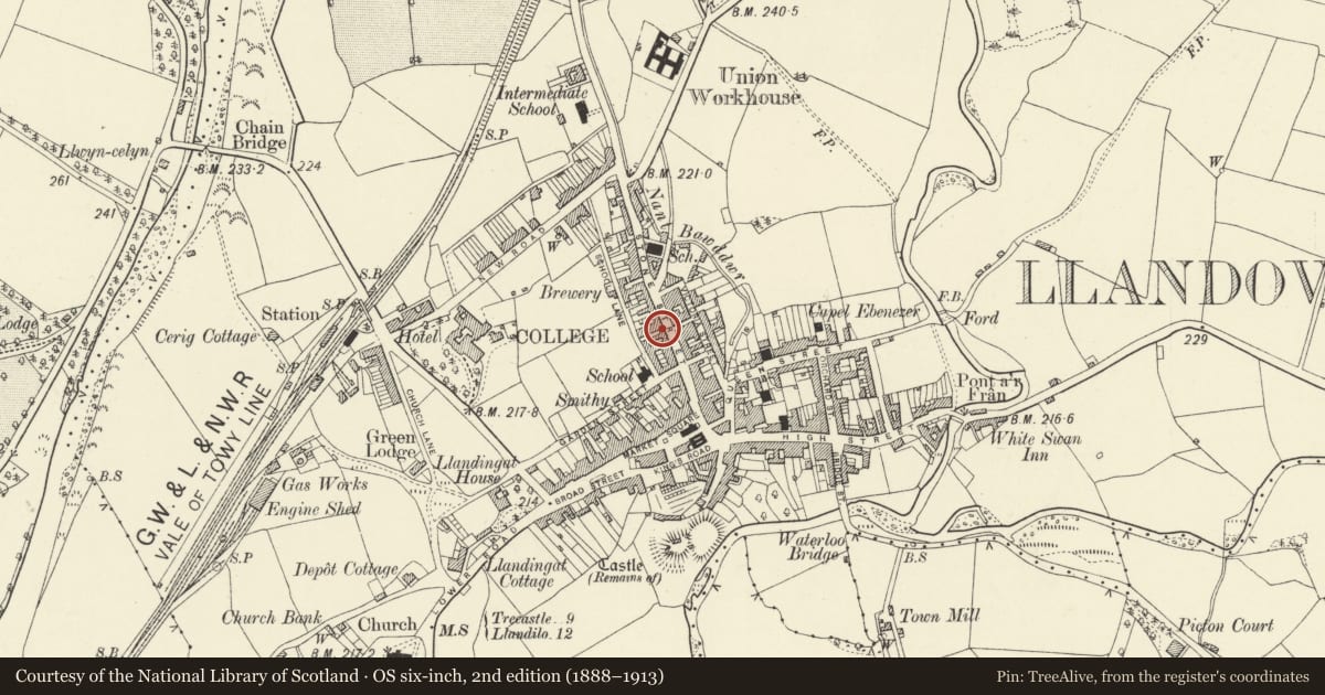
Slide toward Today to fade the historical sheet and see the modern map underneath.
David Rumsey Map Collection, Stanford LibrariesDavid Rumsey Map Collection, Stanford LibrariesDavid Rumsey Map Collection, Stanford LibrariesDavid Rumsey Map Collection, Stanford LibrariesDavid Rumsey Map Collection, Stanford Libraries
5 historical maps cover this location, the earliest the 1860 map "41. Caermathen." (David Rumsey Map Collection, Stanford Libraries).
Historical maps covering this location
- 1860 · 41. Caermathen. (David Rumsey Map Collection, Stanford Libraries)
- 1891 · Sheet 10. Ordnance Survey of England and Wales. . (David Rumsey Map Collection, Stanford Libraries)
- 1898 · 212 Llandovery (Outline) (David Rumsey Map Collection, Stanford Libraries)
- 1898 · 212 Llandovery (Hills) (David Rumsey Map Collection, Stanford Libraries)
- 1901 · Sheet 14. (David Rumsey Map Collection, Stanford Libraries)
Cadw's description
Location
Situated in terraced row opposite Adelaide Street.
History
Terraced house, former Six Bells Inn. Possibly C18 in origin it was The Crown inn by 1810, renamed the Six Bells by 1830, with a malthouse behind.
Described in 1981 as pebbledashed with Victorian door in flat keyed surround and 2 blank panels with scalloped corners between upper windows, and steep slate roof. All facade cladding stripped off since 1981.
Exterior
Terraced house of 3 bays and 2 storeys, with slate gabled roof, close eaves and no chimneys. Exposed riverstone facade (formerly rendered) with cement plinth, 12-pane horned sashes throughout with C20 concrete lintels and C20 central door.
Interior
Interior not inspected, said to have beamed ceilings and floor levels below present pavement level, suggesting early origin.
Reason for designation
Included, notwithstanding loss of original finish on list, as a house possibly of late C18 origins, so one of the older houses on the street. Part of group Nos 26-32.
Nearby in the register
- 28 Stone StreetDomesticunder 1 mi
- 30 Stone StreetDomesticunder 1 mi
- Court HouseDomesticunder 1 mi
- The Plough HotelCommercialunder 1 mi
Other entries of the same register within about three miles of this one, by straight line.