Cof Cymru: National Historic Assets of Wales · Wales
Llandovery Castle
Llandovery, Carmarthenshire, Wales
A Grade II* listed building in Llandovery, Carmarthenshire, designated on 8 March 1966.
The record
- Designation
- Listed building, Grade II*
- Broad class
- Defence
- Date of designation
- 8 March 1966
- Locality
- Llandovery
- Community
- Llandovery
- Unitary authority
- Carmarthenshire
- Country
- Wales
- Coordinates
- 51.99277, -3.79636
- Cadw reference
- 10965
Slide toward Today to fade the historical sheet and see the modern map underneath.
David Rumsey Map Collection, Stanford LibrariesDavid Rumsey Map Collection, Stanford LibrariesDavid Rumsey Map Collection, Stanford LibrariesDavid Rumsey Map Collection, Stanford LibrariesDavid Rumsey Map Collection, Stanford Libraries
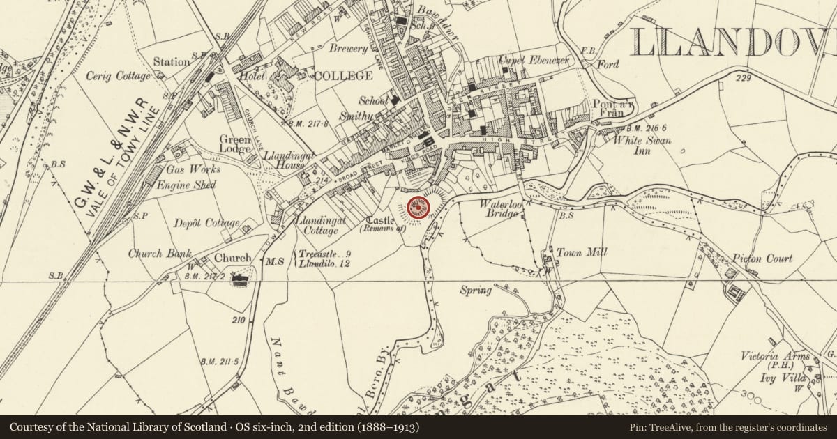
5 historical maps cover this location, the earliest the 1860 map "41. Caermathen." (David Rumsey Map Collection, Stanford Libraries).
Historical maps covering this location
- 1860 · 41. Caermathen. (David Rumsey Map Collection, Stanford Libraries)
- 1891 · Sheet 10. Ordnance Survey of England and Wales. . (David Rumsey Map Collection, Stanford Libraries)
- 1898 · 212 Llandovery (Outline) (David Rumsey Map Collection, Stanford Libraries)
- 1898 · 212 Llandovery (Hills) (David Rumsey Map Collection, Stanford Libraries)
- 1901 · Sheet 14. (David Rumsey Map Collection, Stanford Libraries)
Cadw's description
Location
Situated on prominent natural outcrop overlooking Afon Bran, on SE of main car park.
History
Remant of a medieval castle of late C13. The first castle was an earth motte with bailey, the motte formed from the hill overlooking the Afon Bran, probably built for Richard fitz Pons who was given the lordship of Cantref Bychan in 1116. Repeatedly lost to the forces of the lords of Deheubarth even though Henry II spent a great deal on the castle in 1159-62. It was not secured by the English until 1277, though lost briefly to Llywelyn the Last in 1282. After this it was granted to John Giffard who was instructed to repair the defences and probably built the present masonry castle. It passed to the Barons Audley of Heleigh 1299 who also became Lords of Cemaes in N Pembrokeshire, and passed with Cemaes to the Touchet family in the later C14. Henry IV visited in 1400 and it was besieged by Owain Glyndwr in 1403. It was burnt in an uprising in 1532 by Hywel ap Rhys and thereafter was disused and a quarry for stone. The early C19 views show much the same remains as now.
Scheduled Ancient Monument.
Exterior
Remnants of late C13 castle, chiefly a large D-shaped tower to the W with part of a twin-towered gatehouse with a well-turret to the N and sections of the curtain wall around the motte.
Reason for designation
Included as substantial remains of a medieval castle.
Nearby in the register
- Llandovery CastleCastleunder 1 mi
- 6 Castle StreetNo class recordedunder 1 mi
- 11 Castle StreetDomesticunder 1 mi
- The CopseDomesticunder 1 mi
Other entries of the same register within about three miles of this one, by straight line.