Cof Cymru: National Historic Assets of Wales · Wales
Former Blacksmith's Shop
Talley, Carmarthenshire, Wales
A Grade II listed building in Talley, Carmarthenshire, designated on 8 July 1966.
The record
- Designation
- Listed building, Grade II
- Broad class
- Industrial
- Date of designation
- 8 July 1966
- Locality
- Talley
- Community
- Talley
- Unitary authority
- Carmarthenshire
- Country
- Wales
- Coordinates
- 51.97539, -3.98308
- Cadw reference
- 10962
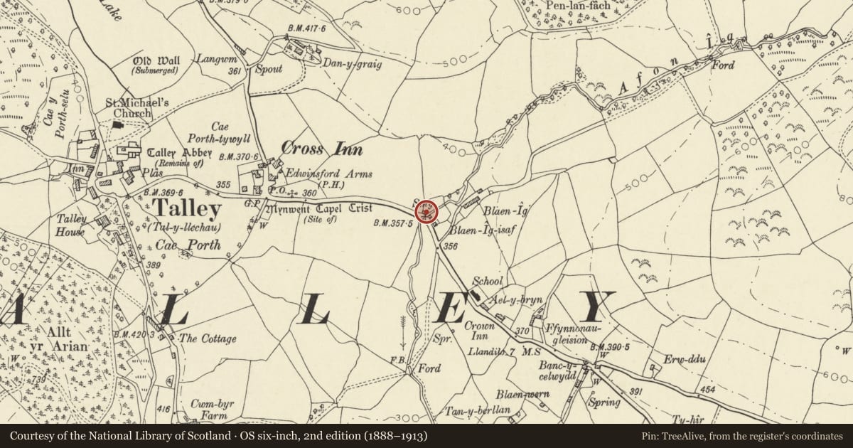
Slide toward Today to fade the historical sheet and see the modern map underneath.
David Rumsey Map Collection, Stanford LibrariesDavid Rumsey Map Collection, Stanford LibrariesDavid Rumsey Map Collection, Stanford LibrariesDavid Rumsey Map Collection, Stanford LibrariesDavid Rumsey Map Collection, Stanford Libraries
5 historical maps cover this location, the earliest the 1860 map "41. Caermathen." (David Rumsey Map Collection, Stanford Libraries).
Historical maps covering this location
- 1860 · 41. Caermathen. (David Rumsey Map Collection, Stanford Libraries)
- 1891 · Sheet 10. Ordnance Survey of England and Wales. . (David Rumsey Map Collection, Stanford Libraries)
- 1898 · 212 Llandovery (Hills) (David Rumsey Map Collection, Stanford Libraries)
- 1898 · 212 Llandovery (Outline) (David Rumsey Map Collection, Stanford Libraries)
- 1901 · Sheet 14. (David Rumsey Map Collection, Stanford Libraries)
Cadw's description
Location
Located on E side of Talley village, alongside the B4302 opposite Dyffryn -ig. Associated cart-house immediately to S.
History
Associated with Thomas Lewis ( 1759-1842 ), Blacksmith and Methodist
Hymnist.
Exterior
Mid/late C19. Single storey, rubble built with slate roof.
Dressed stone chimney-stack to right with stone tabling. Doorway to right, cambered head with stone voussoirs; divided stable type boarded door. 2 windows to right, heads as above. Later 9-pane casements to both with top hung upper lights.
With the adjacent cart-house, an attractive roadside group.
Nearby in the register
- Cart-House to S of former Blacksmith's ShopDomesticunder 1 mi
- The Edwinsford ArmsCommercialunder 1 mi
- Telephone Call-box at road junction set against wall of Pretoria HouseCommunicationsunder 1 mi
- Y PlasDomesticunder 1 mi
Other entries of the same register within about three miles of this one, by straight line.