Cof Cymru: National Historic Assets of Wales · Wales
Tramroad Bridge
Aberdare West, Rhondda Cynon Taff, Wales
A Grade II listed building in Trecynon, Aberdare West, Rhondda Cynon Taff, designated on 10 January 1991.
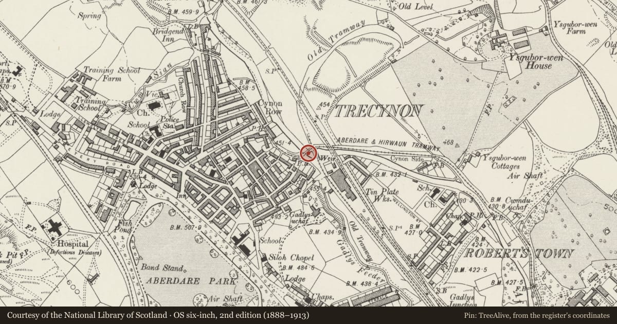
The record
- Designation
- Listed building, Grade II
- Broad class
- Transport
- Date of designation
- 10 January 1991
- Locality
- Trecynon
- Community
- Aberdare West
- Unitary authority
- Rhondda Cynon Taff
- Country
- Wales
- Coordinates
- 51.72240, -3.45328
- Cadw reference
- 10894
Slide toward Today to fade the historical sheet and see the modern map underneath.
David Rumsey Map Collection, Stanford LibrariesDavid Rumsey Map Collection, Stanford LibrariesDavid Rumsey Map Collection, Stanford LibrariesDavid Rumsey Map Collection, Stanford LibrariesDavid Rumsey Map Collection, Stanford Libraries
5 historical maps cover this location, the earliest the 1636 map "Cornubia : Devonia, Somersetus, Dorcestria, Wiltonia, Glocestria ..." (David Rumsey Map Collection, Stanford Libraries).
Historical maps covering this location
- 1636 · Cornubia : Devonia, Somersetus, Dorcestria, Wiltonia, Glocestria ... (David Rumsey Map Collection, Stanford Libraries)
- 1637 · The fourth table of England. Cornub. Devonia, Somerset etc. (David Rumsey Map Collection, Stanford Libraries)
- 1830 · V.3:11-15:XV. Britisches Reich. A. Kon: England. b. Frstenthum Wales: Shire: 37-40 (David Rumsey Map Collection, Stanford Libraries)
- 1865 · England and Wales. England No. 6. (David Rumsey Map Collection, Stanford Libraries)
- 1898 · 231 Merthyr Tydfil (Hills) (David Rumsey Map Collection, Stanford Libraries)
Cadw's description
Location
Spanning the River Cynon immediately below the modern A4059 bypass.
History
Erected in l811 and manufactured by the Abernant Foundry. Carried the tramroad from Abernant across to the Trecynon area; may also have carried traffic for Ysguborwen and Aberdare works.
Exterior
Early cast-iron bridge ca 3m wide and ca l0.5m long; rubble abutments. Decking of cast iron plates on four arched lattice beams. Simple modern iron parapets, one upright is reused and inscribed 'Abernant l8ll'. Ridged top to the deck providing the horses with grip when pulling across the bridge. Abutments are slightly curved outwards at ends. Recently restored and now forming part of a public footpath.
Scheduled Ancient Monument: Gm347
Nearby in the register
- Iron Tram Bridge, RobertstownBridgeunder 1 mi
- 37 & 37a Alma StreetDomesticunder 1 mi
- Hen Dy Cwrdd ChapelReligious, Ritual and Funeraryunder 1 mi
- Heol Y Felin (Capel Y Bedyddwyr)Religious, Ritual and Funeraryunder 1 mi
Other entries of the same register within about three miles of this one, by straight line.