Cof Cymru: National Historic Assets of Wales · Wales
Lodge at driveway to Fron Dolau
New Quay, Ceredigion, Wales
A Grade II listed building in New Quay, Ceredigion, designated on 31 January 1994.
The record
- Designation
- Listed building, Grade II
- Broad class
- Domestic
- Date of designation
- 31 January 1994
- Locality
- New Quay
- Community
- New Quay
- Unitary authority
- Ceredigion
- Country
- Wales
- Coordinates
- 52.21390, -4.36215
- Cadw reference
- 10795
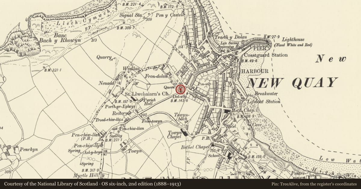
Slide toward Today to fade the historical sheet and see the modern map underneath.
David Rumsey Map Collection, Stanford LibrariesDavid Rumsey Map Collection, Stanford LibrariesDavid Rumsey Map Collection, Stanford LibrariesDavid Rumsey Map Collection, Stanford LibrariesDavid Rumsey Map Collection, Stanford Libraries
5 historical maps cover this location, the earliest the 1608 map "(13) Cambriae Typus." (David Rumsey Map Collection, Stanford Libraries).
Historical maps covering this location
- 1608 · (13) Cambriae Typus. (David Rumsey Map Collection, Stanford Libraries)
- 1830 · V.3:11-15:XV. Britisches Reich. A. Kon: England. b. Frstenthum Wales: Shire: 37-40 (David Rumsey Map Collection, Stanford Libraries)
- 1899 · 194 Llangranog (Hills) (David Rumsey Map Collection, Stanford Libraries)
- 1901 · Sheet 14. (David Rumsey Map Collection, Stanford Libraries)
- 1919 · Sheet 78. Lampeter. (David Rumsey Map Collection, Stanford Libraries)
Cadw's description
Location
Situated on roadside, to right of drive to Fron Dolau.
History
Later C19.
Exterior
Lodge in rock-faced snecked rubble stone with slate roofs. Single storey, L-plan with stone stack on ridge at intersection. Crosswing to right has overhanging eaves and single window with stone voussoirs, similar window on outside S wall, to main road; lean-to rear. Wing to left has door in angle and window to left, both with stone voussoirs to heads.
Reason for designation
Included as part of later C19 small country estate, unusual in the area. Marked on 1887 OS map.
Group value with other listed items at Fron Dolau.
Nearby in the register
- The Queens HotelDomesticunder 1 mi
- WaterlooDomesticunder 1 mi
- Craiga InaDomesticunder 1 mi
- Guild HallDomesticunder 1 mi
Other entries of the same register within about three miles of this one, by straight line.